Nov. 10, 2017 — Photos: Must-see photos of Irma damage in Jacksonville area .... hurricane Irma recap
Rina losing tropical charactersitics......
The "Buresh Bottom Line": Always be prepared!..... City of Jacksonville Preparedness Guide... Georgia Hurricane Guide.
"Rina" has become a post-tropical cyclone over the chilly far N. Atlantic - last NHC advisory was issued Thu. morning.
Persistent but disorganized showers & t'storms -- associated with an upper level low -- continue over the Southeastern Bahamas, Hispaniola & the Eastern Caribbean extending east to Puerto Rico & the Northern Lesser Antilles. No short term surface development is expected as shear is strong, but the Caribbean may be an area to monitor next week for some slow tropical development. In the meantime heavy rain will continue to pour on many of the islands.
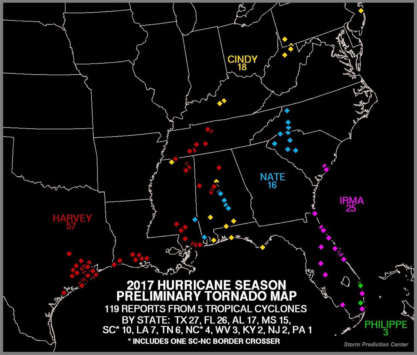
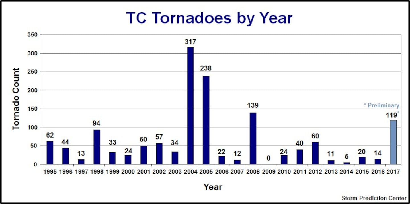
Images below from the Storm Prediction Center showing tornadoes (preliminary counts) spawned by U.S. landfalling tropical cyclones. The great majority were associated with "Harvey" - 57. The 119 for the year ranks 4th since 1995 only behind 2008, 2005 & 2004.
Interesting map below tweeted by Erik Pindrock shows virtually all of Fl. has experienced at least tropical storm force winds this year... as well as the entire Gulf Coast... & as far north as N. Carolina on the east coast:
Deep oceanic heat content is still evident over the Caribbean but is beginning to "bow its head" to late fall.....
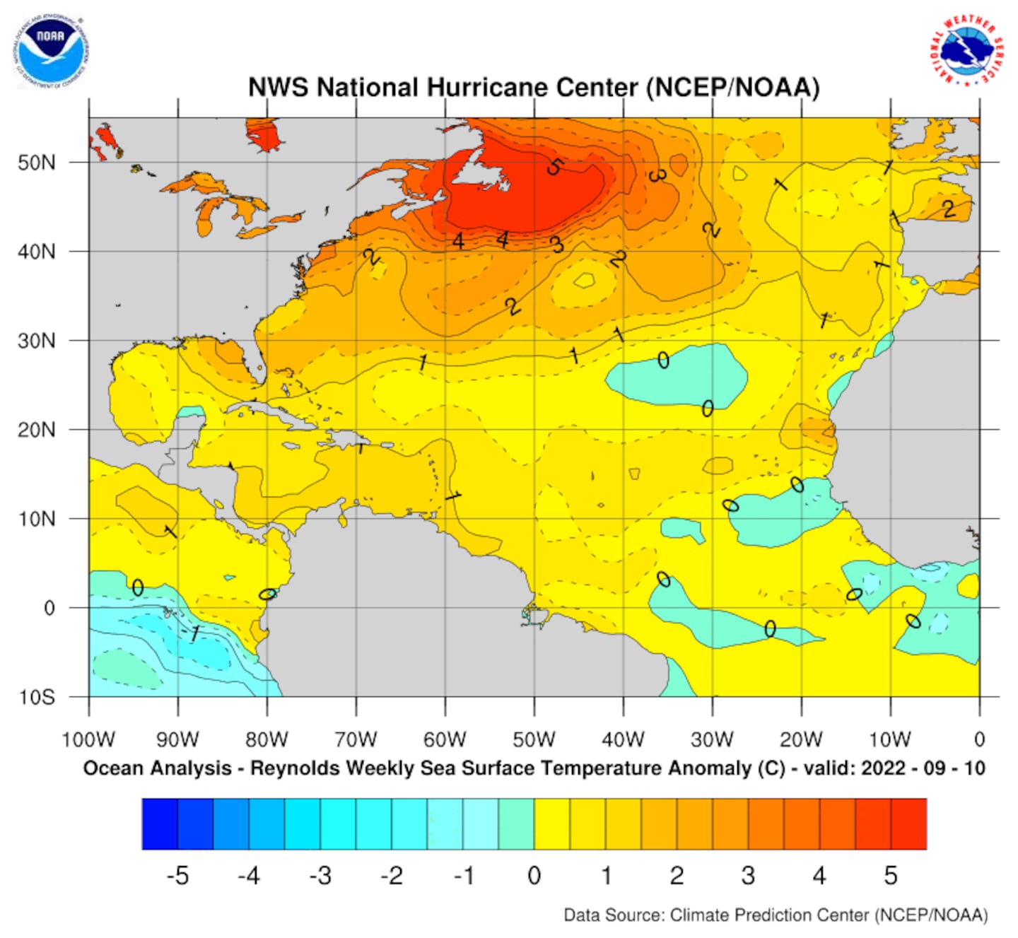
Sea surface temp. anomalies:
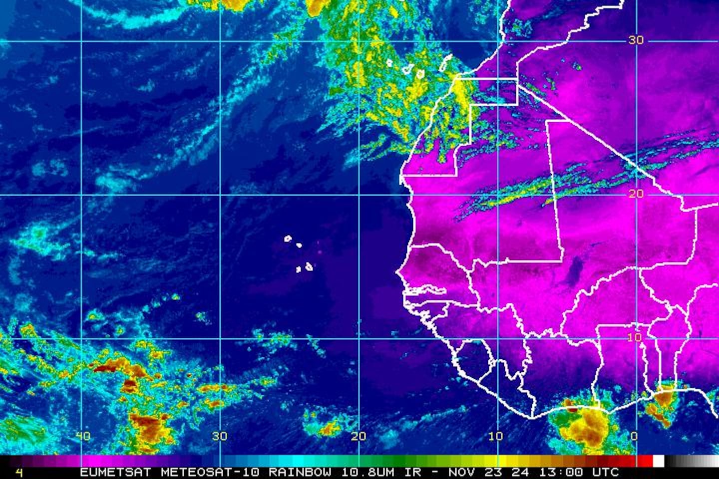
East Atlantic IR satellite:
Mid & upper level wind shear (enemy of tropical cyclones) analysis (CIMMS).
0
SE U.S. surface map:
1
Surface analysis centered on the tropical Atlantic:
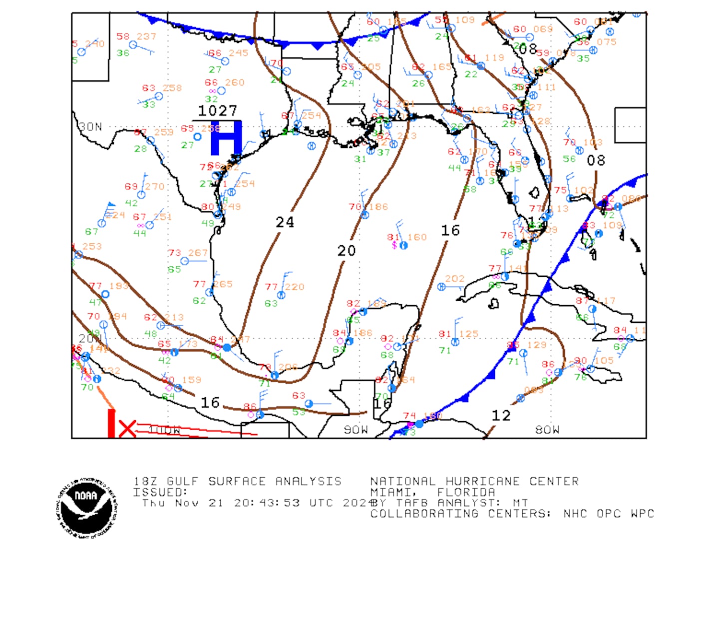
Surface analysis of the Gulf:
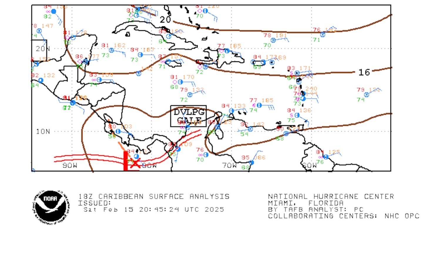
Caribbean:
Extensive hurricane Irma recap - click here.
Cox Media Group


