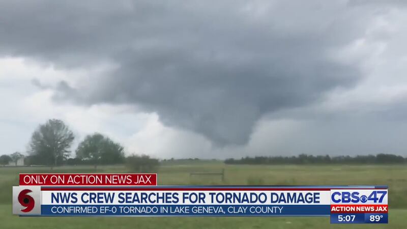
The National Weather Service confirmed on Thursday that an EF-0 tornado touched down in Lake Geneva on Wednesday afternoon.
NWS Jacksonville Meteorologist in Charge Scott Cordero searched the woods on Thursday where the tornado was believed to have touched down, looking for damage.
Cordero said he was looking for snapped trees, but had to look closely to see if they fell a long time ago or if they were fresh.
ORIGINAL STORY: Wednesday's tornado was EF-0 that touched down, officials confirm
Two touch downs were reported, one near Lake Brooklyn and one near the Keystone Airpark.
Action News Jax First Alert Meteorologist Arielle Nixon said it was likely the same tornado.
“It happened around the same time. It’s likely that it was the same storm. Could’ve possibly dropped down in one spot and then moved and dropped down in another. Or there could be a track in this rural area,” said Nixon.
STORY: Aftermath of Hurricane Michael: photos, video
CHOPPER VIDEOS: Damage to Mexico Beach
Cordero spent Thursday trying to connect the dots of possible damage to determine the tornado’s track.
“In addition to that, we look at the direction of the trees as well. Are they converging along a path? And maybe this is an area where the circulation came down again, but was weaker,” said Cordero.
An EF-0 tornado has winds of 65-85 miles an hour.
.@NixonFirstAlert tells me the 2 reported touchdowns in Clay & Bradford Counties yesterday were likely the same #tornado: “It happened around the same time. It’s likely that it was the same storm. Could’ve possibly dropped down in 1 spot & then moved & dropped down in another." pic.twitter.com/TWh6BZ72bx
— Jenna Bourne (@jennabourneWTSP) October 11, 2018
.@NWSJacksonville Meteorologist in Charge Scott Cordero is trying to connect the dots of possible damage to determine the #tornado's track."We look at the direction of the trees as well. Are they converging along a path?" he tells me. Watch at 5 on CBS47 @ActionNewsJax pic.twitter.com/6WCxK66Zde
— Jenna Bourne (@jennabourneWTSP) October 11, 2018
Cox Media Group


