THIS ARTICLE IS NO LONGER BEING UPDATED. CLICK HERE FOR THE LATEST STORM COVERAGE
Hurricane Isaias is now the first hurricane of the Atlantic season. Here’s what you need to know:
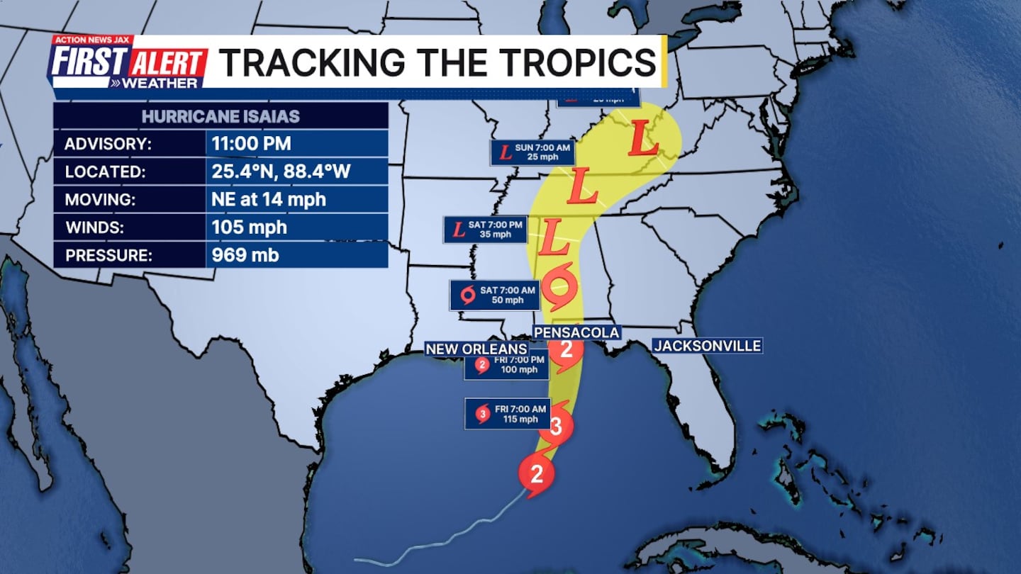
11 p.m. 10/8/26 update:
- Hurricane Isaias is now less than 24 hours from being the first US landfall in 2 years.
- As of the 11 p.m. update, winds are now up to 105 mph, up a bit since the 8 p.m. update.
- Hurricane warnings are in effect for parts of Georgia and Florida, including the panhandle.
- Forecast to briefly become a Category 3 hurricane over the central Gulf.
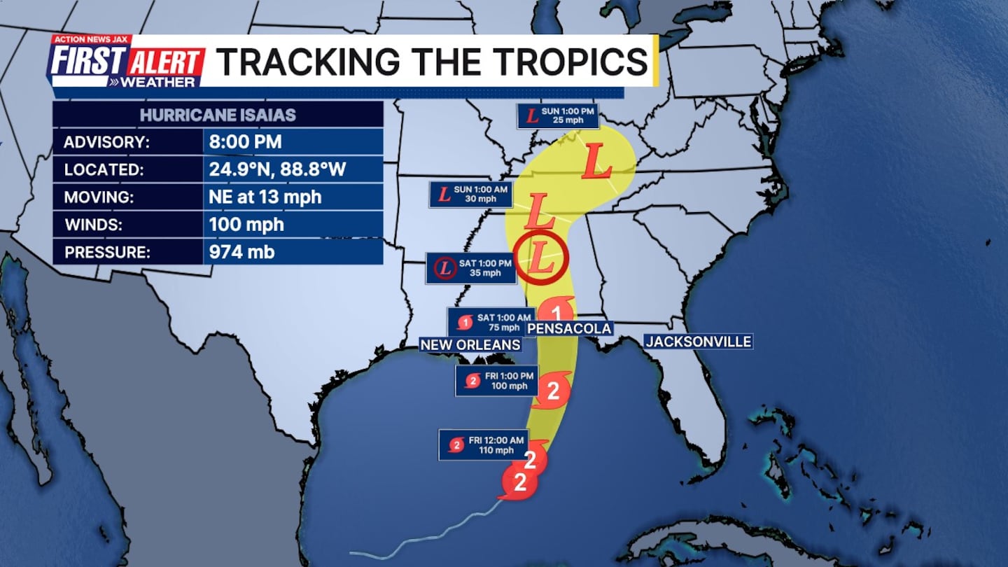
8 p.m. 10/8/26 update:
- Hurricane Isaias strengthens to a Category 2 as it storms closer to the Gulf Coast and makes its way up Florida’s panhandle.
- This prompts tourists and beachgoers to find safer spots inland.
- Expected to bring rain and potential flash flooding.
- States of emergency have been issued in parts of Florida, Georgia, and Alabama. Evacuation orders have been issued in some areas.
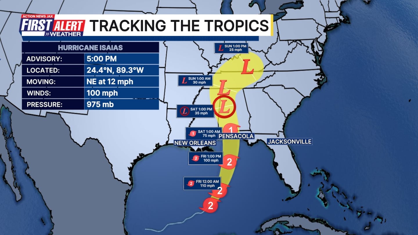
5 p.m. 10/8/26 update:
- Hurricane hunter discovered Isaias now has 100 mph winds.
- Preparations to protect life and property from storm surge and high winds in the warning area should be rushed to completion today, officials from the National Hurricane Center said.
- At the 5 p.m. advisory, there was no change in the areas under watches and warnings.
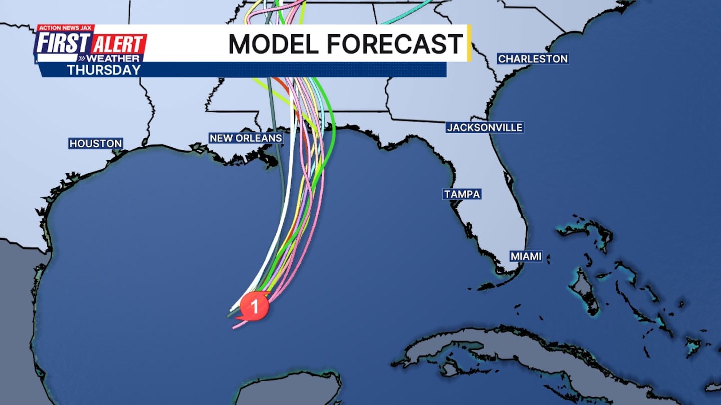
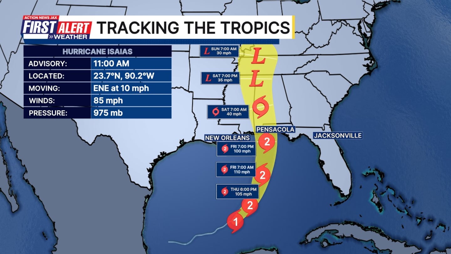
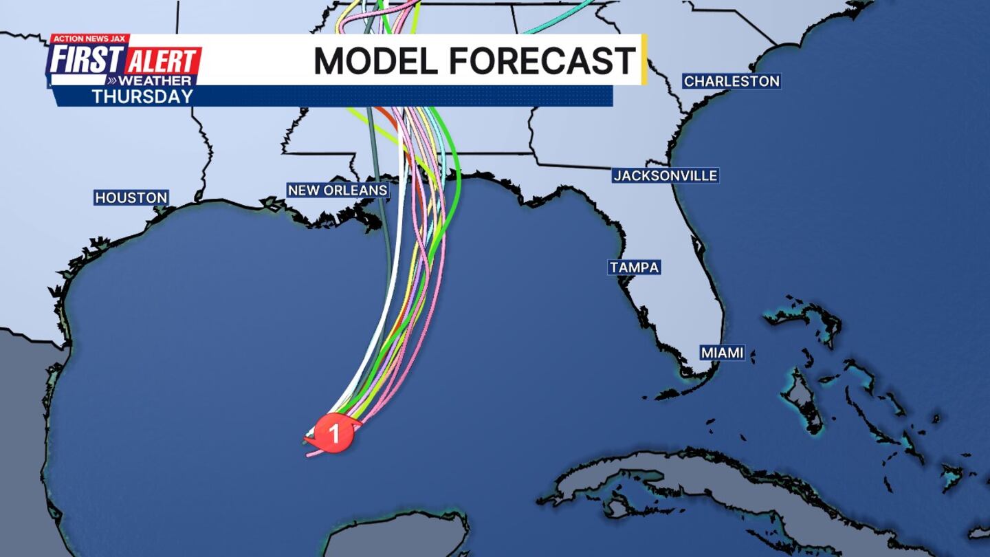
- On the latest forecast track, Isaias is expected to pass north of the Yucatan Peninsula this evening and make landfall along the northern Gulf Coast within the warning area near Pensacola late Friday or early Saturday.
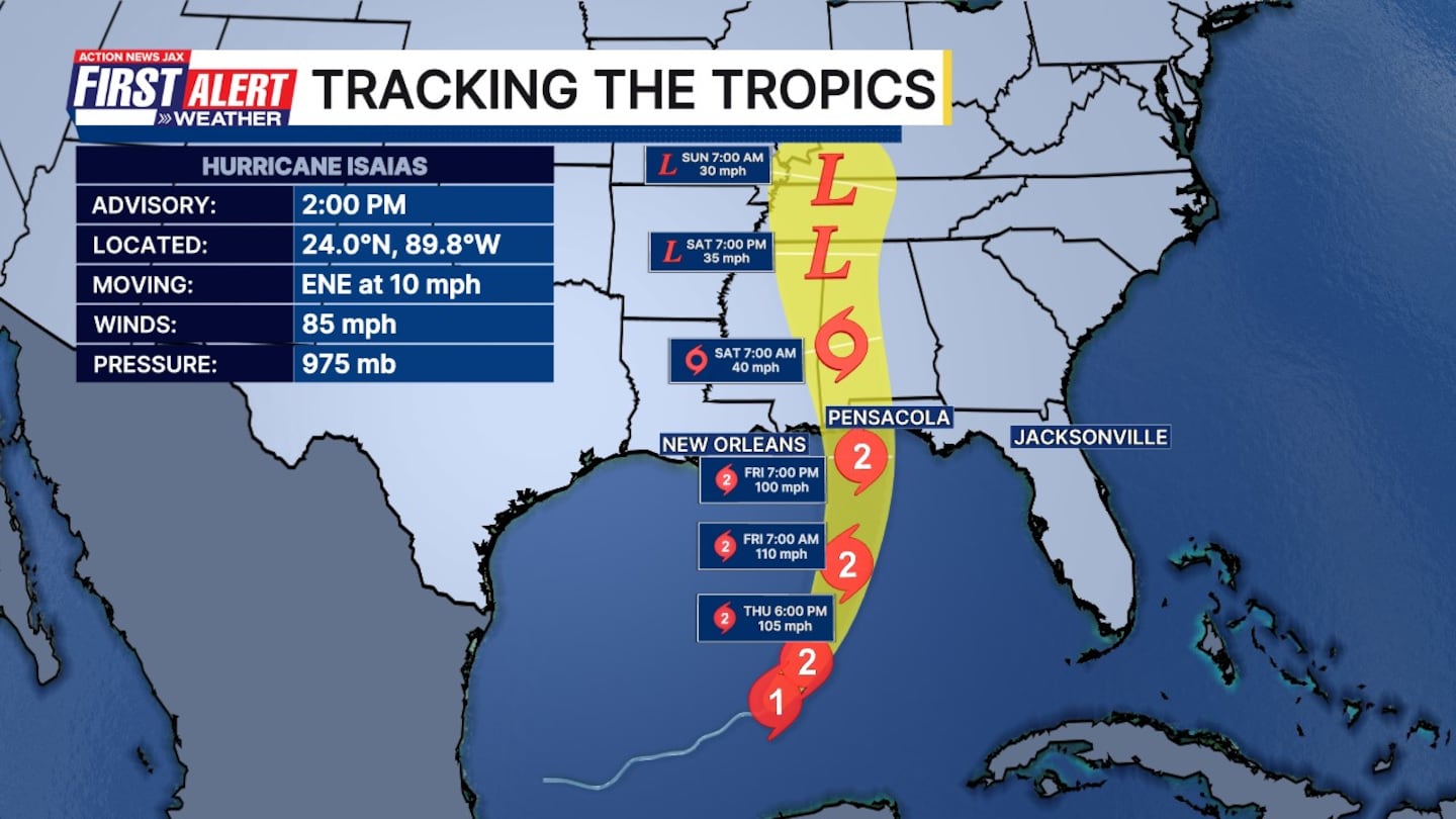
2 p.m. 10/8/26 update:
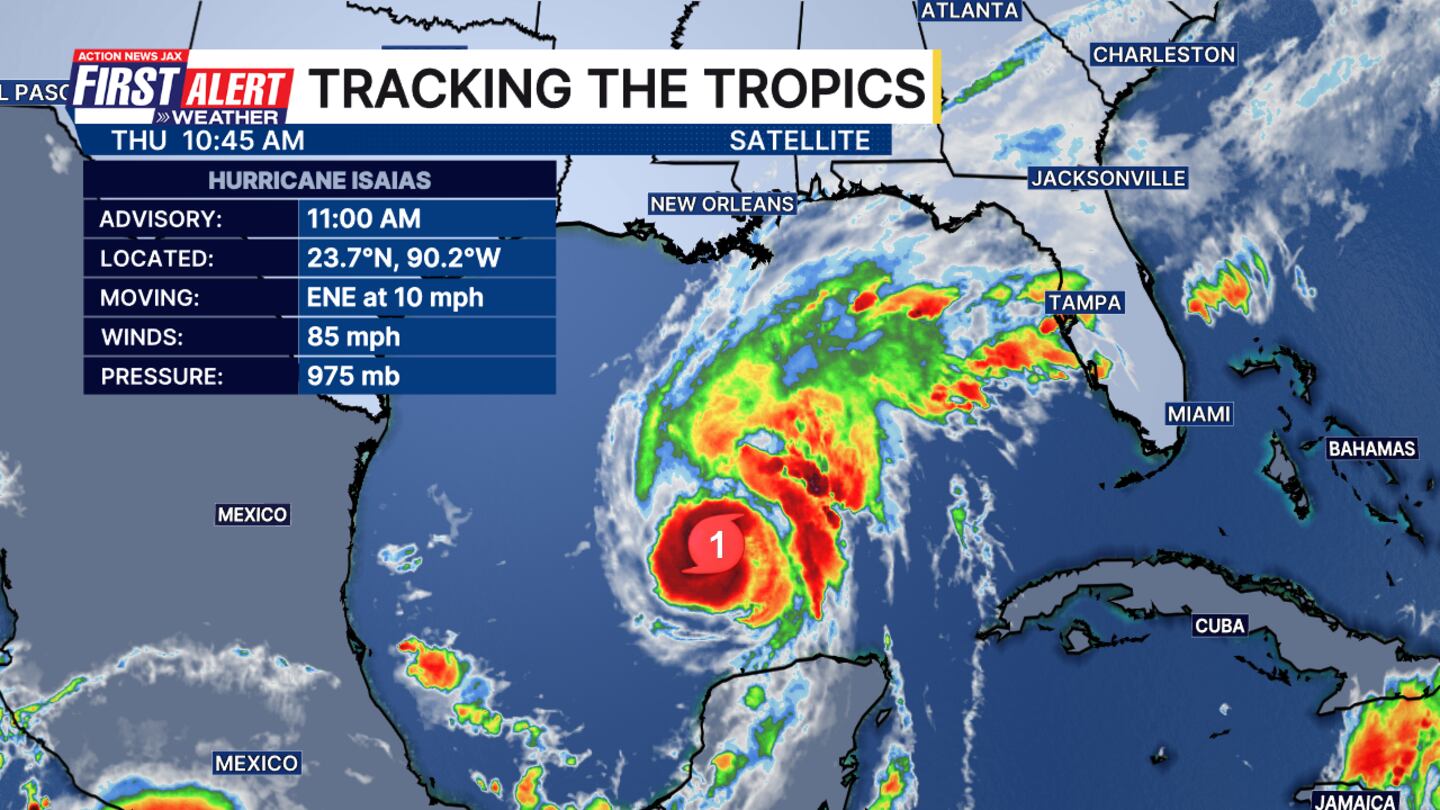
- Isaias is moving east-northeast at 10 mph
- The storm’s minimum pressure is 975 mb
- The maximum sustained winds are 85 mph, keeping it at a Category 1 for now
- Action News Jax First Alert Weather Chief Meteorologist Mike Buresh said in Talking the Tropics with Mike that tropics threats/impacts for Jacksonville/NE Florida/SE Georgia are few.
- There will be some peripheral/outer bands moving rather quickly northward - from Isaias - Friday through the weekend that will be capable of very heavy rain, gusty winds & isolated tornadoes, especially Friday through Saturday.
11 a.m. 10/8/26 update:
- The hurricane’s landfall will be late Friday afternoon/early evening near Pensacola and Mobile.
- Keep in mind that the skinny forecast cone is an indication of high forecast confidence but impacts - strong winds, heavy rain, storm surge, flooding & tornadoes will extend *well beyond* the cone.
- Few direct local impacts but peripheral bands of showers and storms will be heavy at times with at least some threat for strong/severe storms from time to time.
- Anyone with travel plans west on I-10 should stay up to date on the latest forecasts & consider amending travel plans.
- 2026 has established a record for the satellite era - since 1966 - with no Atlantic hurricanes through and beyond Sept. 11th, until last night, October 7th.
Read: Hurricane Isaias, severe storms could impact Georgia-Alabama game
DeSantis issues state of emergency for 25 counties including Baker, Columbia
Florida Gov. Ron DeSantis on Tuesday evening issued a state of emergency for 25 counties that may see impacts from Isaias.
The counties include Baker, Bay, Calhoun, Columbia, Dixie, Escambia, Franklin, Gadsden, Gilchrist, Gulf, Hamilton, Holmes, Jackson, Jefferson, Lafayette, Leon, Liberty, Madison, Okaloosa, Santa Rosa, Suwannee, Taylor, Walton, Wakulla, and Washington.
Oil production and tourism already affected
Ahead of the storm, oil and gas producers shut down a significant share of offshore production in the Gulf, which accounts for almost 15% of crude pumped annually in the U.S.
As of Wednesday about 25% of the oil production in the region was temporarily halted, taking about 511,000 barrels a day off the market, according to the Marine Minerals Administration. It said eight of the Gulf’s 371 manned oil platforms were evacuated.
With oil prices already high, the production cuts are steep enough to affect markets, though other Gulf hurricanes have caused larger disruptions, said Jim Burkhard, global head of crude oil market research for S&P Global Energy. More concerning, he said, is whether Isaias strikes as a powerful storm near refineries.
As it moves inland, Isaias might also disrupt Saturday’s college football showdown between rivals Georgia and Alabama, a game President Donald Trump has planned to attend.
In Alabama, the cities of Gulf Shores and Orange Beach issued a statement encouraging people in low-lying areas to voluntarily evacuate.
Gulf Shores resident Maranie Adams gathered water and other supplies as her family moved belongings, including a hot tub motor, to higher ground. Her family planned to ride out the storm at home, roughly a half-mile from shore, sheltering indoors alongside their flock of chickens.
“We’re having to get crates to bring them into the house so they don’t blow away,” Adams said. “It’s going to be noisy.”
Alabama Gov. Kay Ivey issued a state of emergency for 40 counties, while Florida Gov. Ron DeSantis declared one for 25 counties in the Panhandle and Big Bend regions. The state also planned to deploy a Miami-based urban search and rescue task force.
In Pensacola, electric utilities were pre-positioning crews to quickly repair any power outages. City officials provided sand for residents to fill sandbags to protect their homes against flooding. And Mayor D.C. Reeves urged people to check on older adult neighbors and others who might need help.
“Obviously no need to panic at this point,” Reeves told a news conference. “This is really about preparation.”
WATCH THE FORECAST | DOWNLOAD THE APPS
Follow Action News Jax Meteorologists on Twitter for updates:
Mike Buresh | Garrett Bedenbaugh | Corey Simma | Trevor Gibbs
ALLERGY TRACKER: See what the pollen counts look like in our area
LISTEN: Mike Buresh ‘All the Weather, All the Time’ Podcast
INTERACTIVE RADAR: Keep track of the rain as it moves through your neighborhood