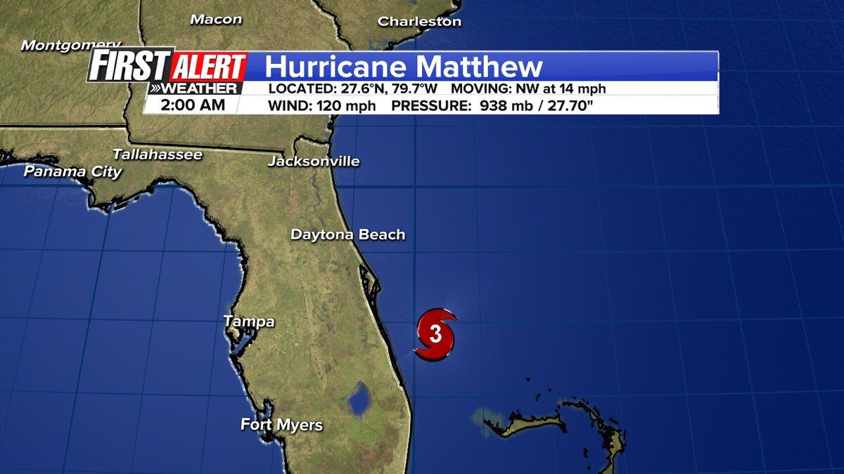
JACKSONVILLE, Fla. — The latest advisory for Hurricane Matthew showed a slight shift east in its track.
The Category 3 storm is packing 120 mile per hour winds.
UPDATED STORY: Hurricane Matthew approaches Florida's east coast
It made landfall on Grand Bahama Island at 8 p.m. and is expected to hit Brevard County by morning.
Latest #HurricaneMatthew update from NHC shows winds still at 130 miles per hour #Firstalertwx pic.twitter.com/tVppFk0rhD
— ActionNewsJax (@ActionNewsJax) October 7, 2016
Download the Action News Jax News app and First Alert Weather app
The storm will make its nearest approach to Jacksonville's coast Friday afternoon and evening.
Jacksonville officials said the time to evacuate has passed. They are urging people to stay at home as of Thursday night.
Local impacts expected to include:
- Sustained high winds along the coast with gusts up to hurricane force (74 mph+)
- Extremely rough seas and surf
- Life-threatening rip currents
- Beach erosion
- Coastal flooding
Warnings
A Hurricane Warning has been issued for Duval, St. Johns, Nassau, Clay and Putnam counties in Northeast Florida and Camden and Glynn counties in Southeast Georgia.
A Tropical Storm Warning has been issued for Columbia, Baker, Union and Bradford, Ware, Pierce, Brantley, and Charlton counties. A Flood Watch will be in effect for Duval, St. Johns, Nassau, Clay, Putnam, Glynn and Camden counties from 8 a.m. Thursday through late Friday night. Winds for Matthew were at 125 miles per hour at the 5 a.m. advisory Thursday.
Evacuation zones, routes and other emergency information
Impacts
Bands of heavy rain will begin to increase Thursday and continue into Friday.
Rain and higher than average tides along with breaking waves may lead to flooding along the coast and even inland along the St. Johns River.
Northeast Florida counties are already offering sandbags in preparation for heavy rain, wind and beach erosion.
The First Alert Weather Team is monitoring Hurricane Matthew. Stay updated with the First Alert Hurricane Center, Talking the Tropics with Mike and watch Action News Jax.
Emergency links, evacuation zone information for Hurricane Matthew
This morning ALL of our coastal counties are under a HURRICANE WARNING. [St Johns, Duval, Nassau, Clay, Putnam, Camden, Glynn] <a href="https://t.co/e7zUt3XaZw">pic.twitter.com/e7zUt3XaZw</a>
This morning ALL of our coastal counties are under a HURRICANE WARNING. [St Johns, Duval, Nassau, Clay, Putnam, Camden, Glynn] pic.twitter.com/e7zUt3XaZw
— Arielle Nixon (@NixonFirstAlert) October 6, 2016
Good Morning -To answer THE question YES the bridges are still OPEN & likely will be until some point Friday...be careful! @ActionNewsJax
— First Alert Traffic (@ActionTraffic) October 6, 2016
#Matthew made landfall at 8 pm EDT on the western end of Grand Bahama Island with maximum sustained winds of 130 mph https://t.co/tW4KeGdBFb pic.twitter.com/76dCiGL9YI
— National Hurricane Center (@NHC_Atlantic) October 7, 2016
Interesting fact from NHC discussion about Nicole and Matthew in ATL Basin simultaneously. Dora comparison. pic.twitter.com/FjQFSscB9e
— Garrett Bedenbaugh (@wxgarrett) October 7, 2016
Hurricane Matthew is as serious as it gets. Listen to local officials, prepare, take care of each other. https://t.co/Vaf8Xubs0s
— President Obama (@POTUS44) October 6, 2016
Cox Media Group


