Jacksonville, Fla. — This live updates story from Wednesday has been archived. You can follow Thursday updates for Hurricane Milton here.
As Florida braces for Hurricane Milton’s arrival, it’s imperative that residents prepare to keep themselves and their families safe. Here are live updates from Action News Jax as we follow the storm, providing timely and critical information as it comes in.
*Bookmark this link and refresh it often, as projections can change.
Follow Action News Jax Meteorologists on Twitter for updates:
Mike Buresh | Garrett Bedenbaugh | Corey Simma | Trevor Gibbs
LIVE UPDATES:
11:22 p.m. Wednesday: Part of the roof was torn off Tropicana Field, where the Tampa Bay Rays play in St. Petersburg.
Roof is gone at Tropicana Field #milton #rays
— Nick Burch (@PageWebber) October 10, 2024
Video by: Nick Friedman@mysuncoast @WESH pic.twitter.com/VME6Um351J
Reporter Kailey Tracy at FOX13 Tampa Bay said no one was injured due to the roof damage. A crane also collapsed near the stadium and no one was injured in that incident either, Tracy reports.
NEW: St. Pete officials confirm crane collapsed at 400 Central building construction site and roof damage at Tropicana Field. Thankfully, no injuries at either. Public urged to continue to shelter in place and avoid both areas.
— Kailey Tracy Fox 13 (@KaileyTracy) October 10, 2024
10:05 p.m. Wednesday: Hurricane Milton is now a Category 2 hurricane with winds of 110 mph.
10:01 p.m. Wednesday: Nassau County Emergency Management said it is issuing an evacuation order as “storm surge projections for Nassau County have increased.”
The county said the projected surge has the potential for water intrusion into homes during the high tide in the following areas:
Zone A: Egan’s Creek (Area), Crane Island (All), Long Point (All), 6th Street and Calhoun Street (Area), River Crossing Way (North of Bonnieview Road)
Zone D: Piney Island (All), Marsh Lakes (All), Holly Point (All), Brady Point (All), Oyster Bay(Area), River Marsh Bend (All)
A shelter is available at Wildlight Elementary, 550 Curiosity Ave, Yulee, FL 32097.
8:45 p.m. Wednesday: The National Hurricane Center reports that Hurricane Milton has made landfall as a Category 3 hurricane near Siesta Key, which is in Sarasota County on the southwest Florida coast.
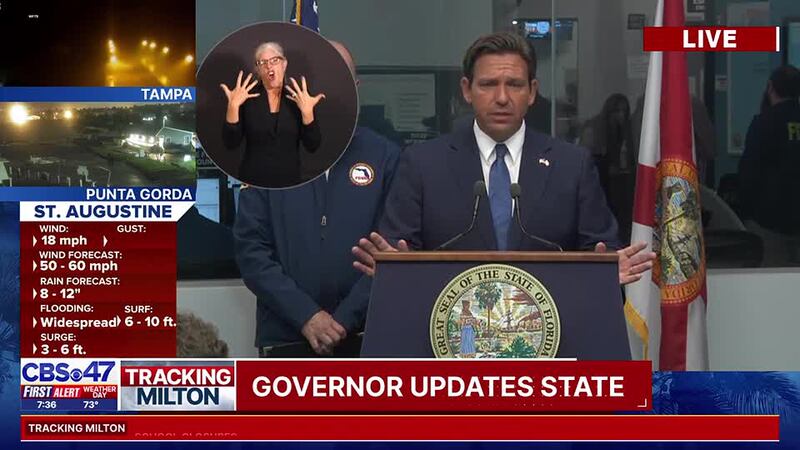
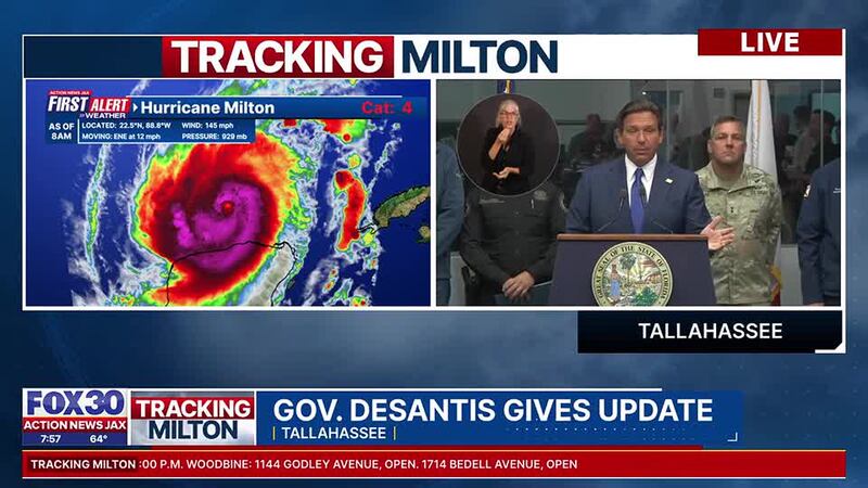
8 p.m. Wednesday: Florida Gov. Ron DeSantis said so far, there have been 116 tornado warnings in the state as Hurricane Milton comes closer to making landfall.
DeSantis also said there have 19 confirmed tornado touch downs in the state.
Watch his briefing below:
7:20 p.m. Wednesday: A curfew is currently in effect for Flagler County from 7 p.m. to Thursday at 7:30 a.m. If you are stopped by law enforcement and don’t qualify for an exception, you could be arrested.
🚨𝗧𝗵𝗲 𝗰𝘂𝗿𝗳𝗲𝘄 𝗶𝘀 𝗻𝗼𝘄 𝗶𝗻 𝗲𝗳𝗳𝗲𝗰𝘁 𝗮𝗰𝗿𝗼𝘀𝘀 𝗙𝗹𝗮𝗴𝗹𝗲𝗿 𝗖𝗼𝘂𝗻𝘁𝘆.
— Flagler County Sheriff’s Office (@FlaglerSheriff) October 9, 2024
If you are out, be prepared to be stopped by a law enforcement officer. If you do not qualify for an exception, you can expect to be arrested.
Stay inside and stay safe. pic.twitter.com/U9wBVYZeFC
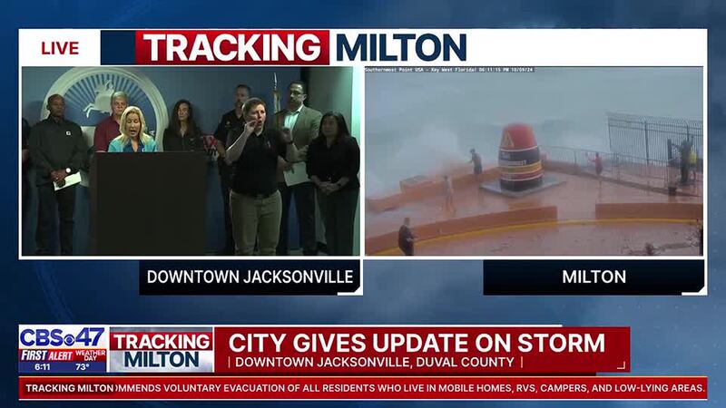
6:30 p.m. Wednesday: Jacksonville Mayor Donna Deegan said there is still time to use the city’s shelters. She said there are 614 in the city’s 6 shelters, which puts them at about 22 to 27% at capacity.
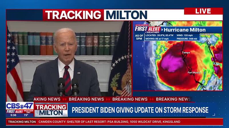
5:30 p.m. Wednesday: President Biden delivered a statement on Hurricane Milton and its coming impact on Florida. The number of Florida power outages has exceeded 250,000.
5:00 p.m. Wednesday: Power outages in Florida are rapidly increasing, with over 120,000 reported and rising.
5PM - Power outages are quickly rising across the state of Florida as #Milton approaches. ~120,000 and rising. @ActionNewsJax #firstalertwx #flwx pic.twitter.com/SnL8EcUL7z
— Trevor Gibbs (@TrevorsWeather) October 9, 2024
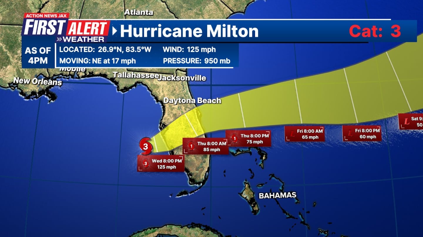
4:11 p.m. Wednesday: Hurricane Milton has once again weakened to a Category 3 storm just hours before making landfall.
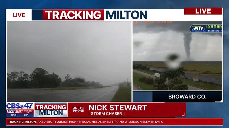
2:55 p.m. Wednesday: Hurricane Milton is still hours away from its Florida landfall, but the storm is spinning up tornados in Osceola County. Storm Chaser Nick Stewart talked to Action News Jax’s Emily Turner and Phil Amato, showing them what he’s seeing there (video below).
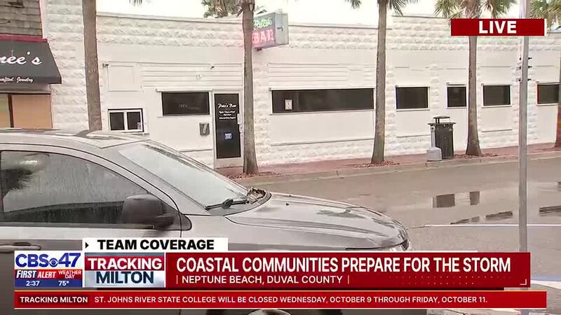
2:15 p.m. Wednesday: It’s a mixed bag reaction in Neptune Beach. Some businesses are boarded up and gone. Others - Pete’s Bar - is still open. Here’s what Action News Jax’s Meghan Moriarty saw when she was there (video below).
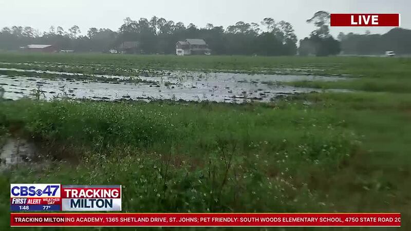
1:55: p.m. Wednesday: Check out this live shot from Action News Jax Shanila Kabir. She was in Elkton in western St. Johns County near Putnam County. We’re still hours away from the major impacts of Hurricane Milton and it already looks like this (video below).
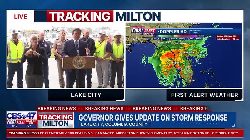
1:30 p.m. Wednesday: Gov. DeSantis was in Lake City Wednesday giving an update on the state’s response and readiness for Hurricane Milton (watch video below). Lake City is still recovering from Hurricane Helene just about two weeks ago.
12:30 p.m. Wednesday: Crews closed the Main Street Bridge in Downtown Jacksonville. The closure is not weather related and will reopen after workers finish “locking it down” to prevent the drawbridge from going up during the storm.
READ: When will bridges close in Jacksonville?
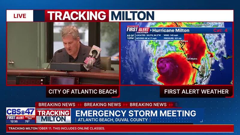
WATCH: Atlantic Beach city leaders hold emergency storm meeting. (video below)
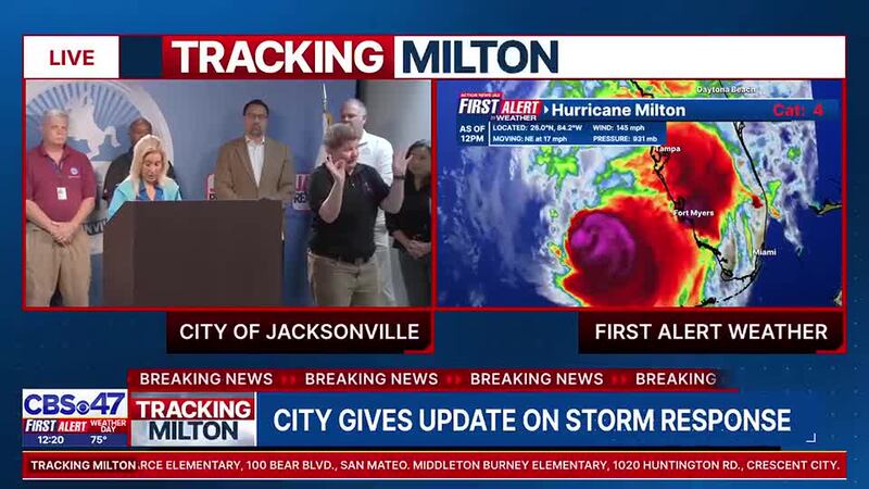
Noon, Wednesday: Jacksonville Mayor Donna Deegan is giving an update on the city’s hurricane preparations. The city opened six shelters at 8 a.m. As of noon, Deegan said 380 people are sheltering in the city’s facilities. Deegan said the city is prepared to open more shelters if the facilities hit a 75 percent occupancy rate.
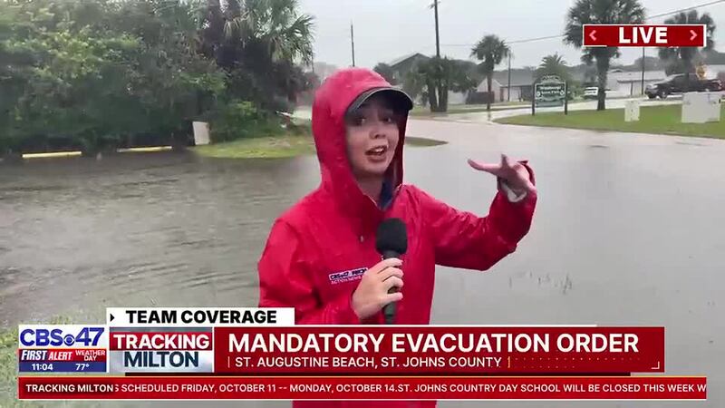
11:22 a.m. Wednesday: Some streets in St. Augustine Beach are already showing signs of flooding and Hurricane Milton hasn’t even arrived there yet. Check out this live shot from Action News Jax Alexus Cleavenger showing the road ponding at Butler Beach (video below)
If the power goes out overnight or tomorrow -- you can still watch our coverage live on our mobile apps as we track Milton's impacts.@ActionNewsJax #Milton #FirstAlertWX pic.twitter.com/kp85TNTVyW
— Garrett Bedenbaugh (@wxgarrett) October 9, 2024
11 a.m. Wednesday: Latest Hurricane Milton forecast and projections (video below).
10:40 a.m. Wednesday: Gov. Ron DeSantis gave a storm update and said more that 50,000 line from out of the state are in Florida to help. Some are from as far away as California.
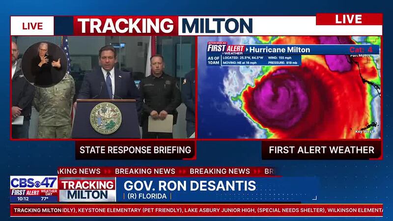
10:35 am. Wednesday: Full DeSantis news conference (video below)
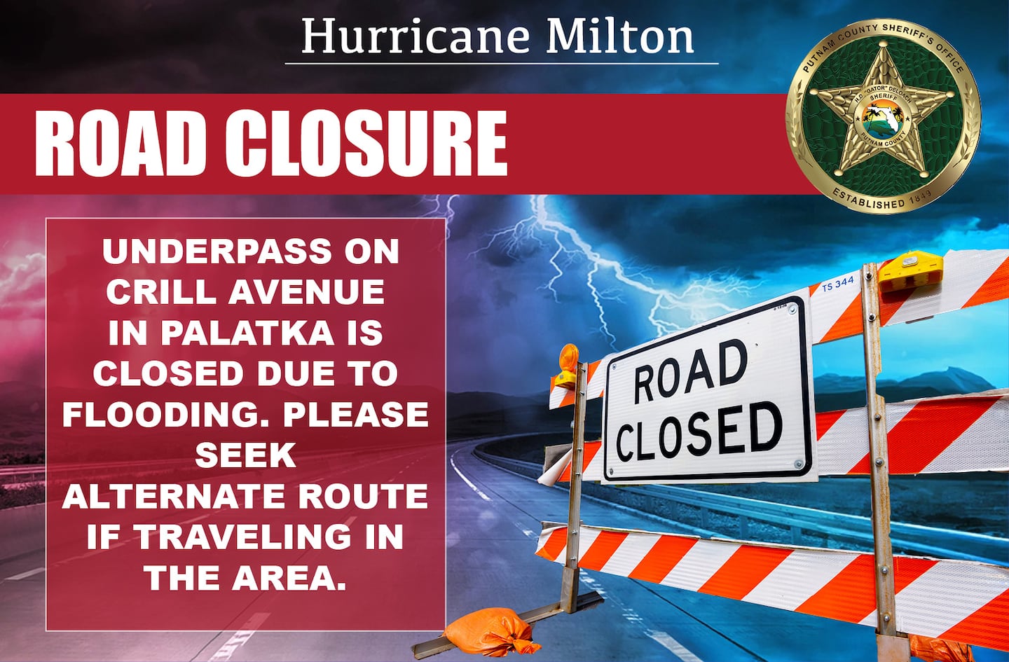
10:10 a.m. Wednesday: Road closure announced in Putnam County due to flooding at the underpass at Crill Avenue in Palatka.
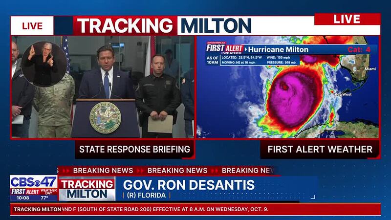
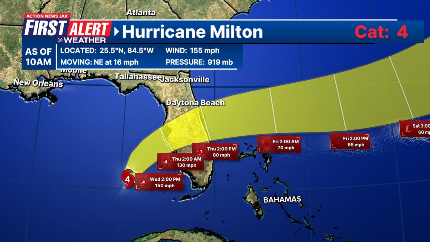
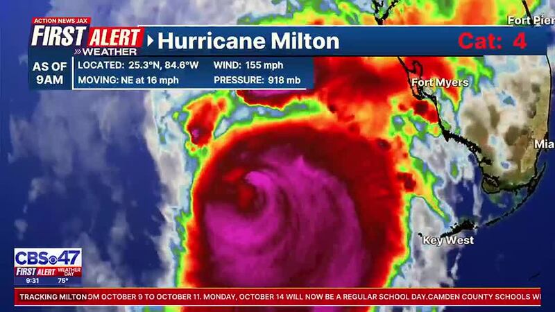
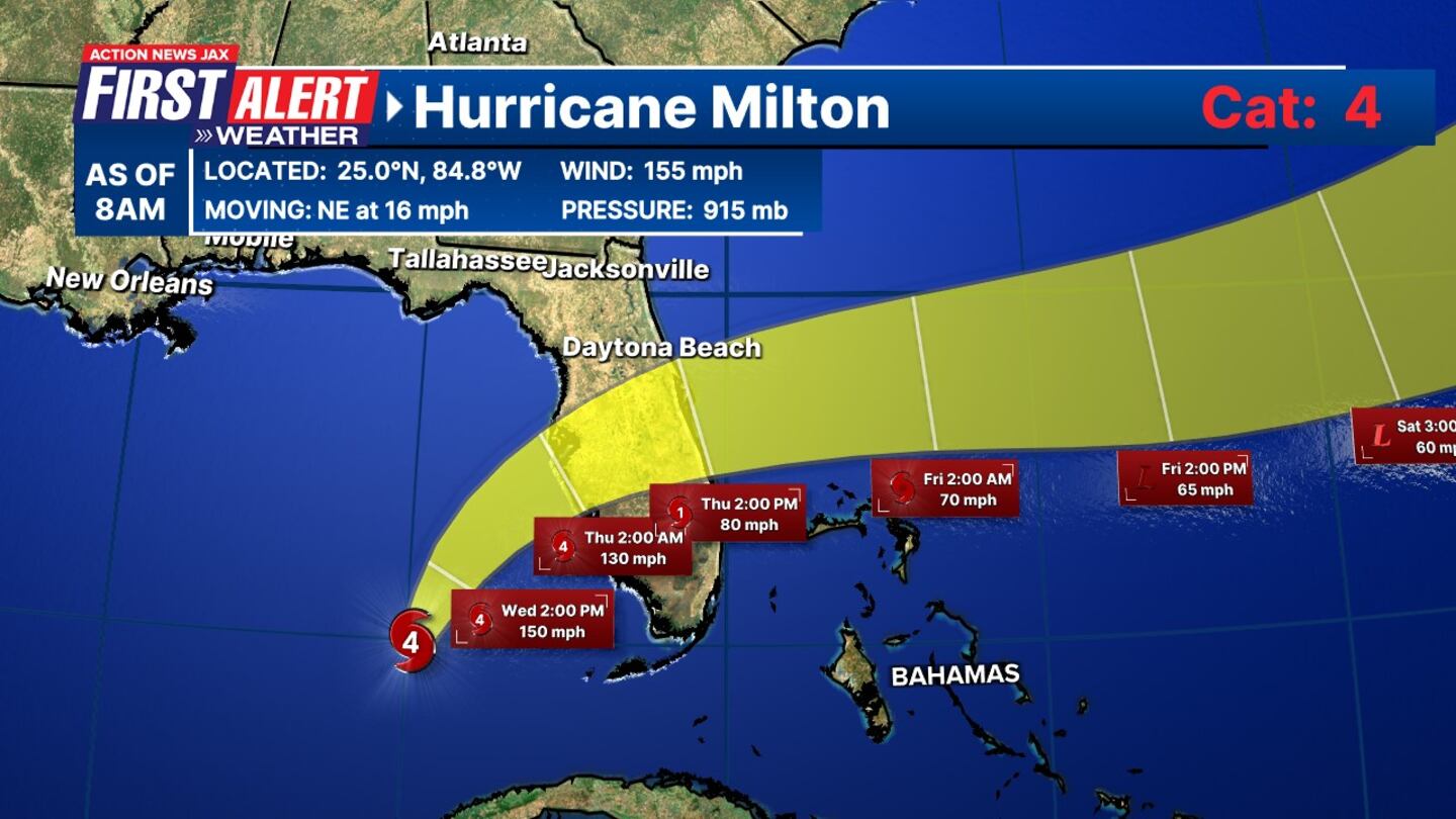
10 a.m. Wednesday: Latest Hurricane Milton cone still has the massive storm as a category 4. Landfall expected around 2 a.m. south of Tampa Bay.
TRACKING THE TROPICS | The latest stats and track. More: https://t.co/W3ACmPc5wI. #FirstAlertWX pic.twitter.com/V8mtJN21RT
— Garrett Bedenbaugh (@wxgarrett) October 9, 2024
9:30 a.m. Wednesday: Here’s the latest forecast
Some folks are still filling up sandbags in Butler Beach along A1A. @ActionNewsJax pic.twitter.com/Fi5FJSo1cf
— Alexus Cleavenger (@alexusctv) October 9, 2024
9 a.m. Wednesday: Latest Hurricane Milton cone.

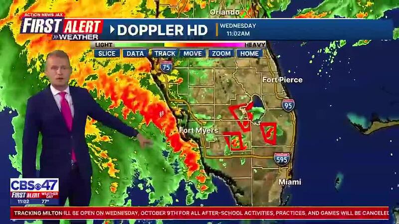
8:10 a.m. Wednesday: Latest cone for Hurricane Milton has the massive storm making landfall around 2 a.m. near Tampa Bay / Sarasota. Local impacts from Milton will arrive Wednesday afternoon and will linger into Thursday.
This graphic depicts just how sharp of a rainfall gradient our area will see from #Milton. This is model output showing potential for more than a foot of rain in southern St. Johns. With heavy rain already falling over much of the county, this is becoming likely. @ActionNewsJax pic.twitter.com/3y0GyhIu9y
— Trevor Gibbs (@TrevorsWeather) October 9, 2024
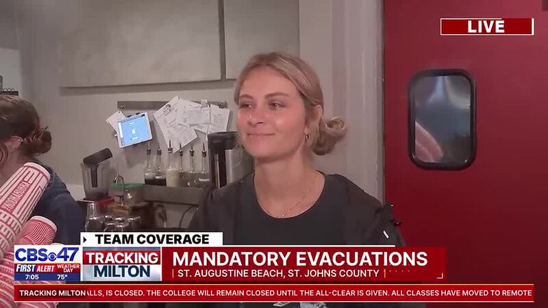
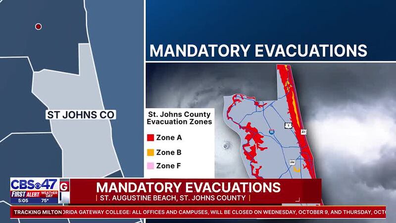
8 a.m. Wednesday: Mandatory evacuations are in effect now in St. Augustine and St. Augustine Beach. Action News Jax Alexus Cleavenger just talked to a restaurant owner who said she not leaving. (Video below)
Already an inch and a half+ in Central and Southern St. Johns county with the rain ahead of #Milton. @NWSJacksonville #FirstAlertWX 8 AM pic.twitter.com/YWgZb4fbny
— Garrett Bedenbaugh (@wxgarrett) October 9, 2024
Evacuation shelters in St. Johns County open at 8am.
— St. Johns County Sheriff's Office (@TeamSJSO) October 9, 2024
> Special Medical Needs: Freedom Crossing Academy, 1365 Shetland Drive, St. Johns
> Pet Friendly: South Woods Elementary School, 4750 State Road 206 West, Elkton
> General Population: Pedro Menendez High School, 600 State… pic.twitter.com/J4kqFEuXvd
8 a.m. Wednesday: Emergency shelters open in Jacksonville.
Six Emergency Shelters opened this morning at 8:00 a.m. If you need a safe space to take refuge from Milton, please visit one of the following locations:
— JaxReady (@JaxReady) October 9, 2024
🔹Arlington Middle School - (8141 Lone Star Rd), open for general population.
🔹Atlantic Coast High School (9735 R. G. Skinner… pic.twitter.com/5VNyCRTxKI
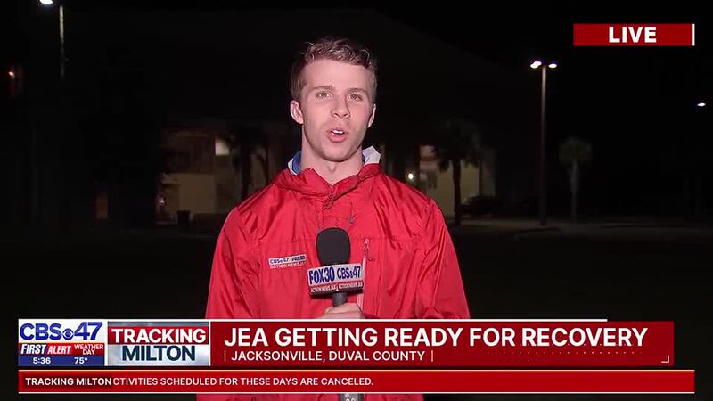
6:10 a.m. Wednesday: JEA expects widespread power outages and created a stagging area at the Equestrian Center in Jacksonville for its crews to get ready to restore power. Action News Jax Logan McDonald is there and here’s what he learned (video below).
5:25 a.m. Wednesday: Mandatory evacuations go into effect in the cities of St. Augustine and St. Augustine Beach at 8 a.m. Streets are empty there and businesses are boarded up. Action News Jax Alexus Cleavenger is there and here’s what she’s seeing (video below).
5 a.m. Wednesday: Milton remains a category 5 hurricane in the Gulf of Mexico and is expected to make landfall just south of Tampa Bay / Sarasota around midnight-2a.m.. Some weakening is expected when it makes landfall, but it’s still expected to be a major hurricane, category 4, when it reaches land.
Local impacts from Milton will arrive Wednesday afternoon and will linger into Thursday.
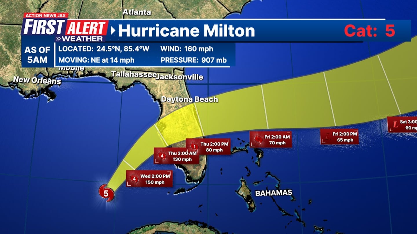
11 p.m. Tuesday: Milton remains a powerful Category 5 hurricane as it moves toward Florida. Its winds are 160 mph and it is moving northeast at 12 mph.
8 p.m. Tuesday: Milton remains a powerful Category 5 major hurricane in the southern Gulf.
5 p.m. Tuesday: Hurricane Milton is back up to a category 5 with winds of 165 mph and a pressure of 918 mb. The storm is moving east northeast at 9 miles per hour.
12:30 p.m. Tuesday: St. Johns County has issued a mandatory evacuation order for the entire City of St. Augustine, beginning at 8:00 a.m. on Wednesday, October 9. Emergency shelters will open at 8:00 a.m. on Wednesday.
Noon, Tuesday: St. Johns County has announced mandatory evacuation orders for Zones A (along coastal and river areas, B, and F (South of State Road 206) effective at 8 a.m. on Wednesday, Oct. 9. You can find which zone you are in HERE.
- Residents living in boats, RVs, mobile homes, and low-lying flood-prone areas throughout the county are also required to evacuate.
Three storm shelters will open at 8 a.m. on Wednesday, Oct. 9, to accommodate evacuees:
- Special Medical Needs: Freedom Crossing Academy, 1365 Shetland Drive, St. Johns
- Pet Friendly: South Woods Elementary School, 4750 State Road 206 West, Elkton
- General Population: Pedro Menendez High School, 600 State Road 206 West, St. Augustine
For detailed evacuation information, route maps, and updates, visit www.sjcfl.us/hurricane or call the Citizen Information Hotline at 904-824-5550.
St. Johns County has issued mandatory evacuation orders due to Hurricane Milton.
— St. Johns Co EOC (@StJohnsEOC) October 8, 2024
Visit https://t.co/jIblHKWf1d for more info.#MYSJCFL pic.twitter.com/M7aw8gdwRD
10:05 a.m. Tuesday: The Florida National Guard (FLNG) has fully activated to support the state’s response efforts. Governor Ron DeSantis authorized the activation, and preparations are in place to ensure immediate action once the storm makes landfall.
- Liaison Officers have been positioned in 20 counties to coordinate mission requirements.
- FLNG has received 43 mission requests and is prepared to execute them.
- The Guard has pre-positioned the following assets:
- 12 rotary aircraft
- 13 boats
- 440 high-wheeled tactical vehicles
Residents should continue to follow local emergency updates as the storm nears. For further information and images from the response efforts, visit DVIDS.
8:11 a.m. Tuesday: Hurricane warnings have been issued for St. Johns and Putnam counties
Duval, Nassau, and Clay counties have tropical storm warnings and a Hurricane Watch.
Storm Surge Warnings have been issued for Northeast Florida and the St. Johns River.
A lot of you may have just gotten jolted by an emergency alert on your phones. Our storm surge watch is now a storm surge WARNING for NE Florid and the St. Johns river.
— Garrett Bedenbaugh (@wxgarrett) October 8, 2024
Also -- hurricane warning now for St. Johns and Putnam counties... TS warning Duval, Nassau and Clay… pic.twitter.com/MG370rkWrQ
7:45 a.m. Tuesday: Governor Ron DeSantis holds a press conference in Tallahassee to provide an update on major Hurricane Milton.
7:00 a.m. Tuesday: Milton remains a category 4 hurricane in the Southern Gulf of Mexico. It’s expected to go back up to a cat 5 sometime in the morning or early afternoon.
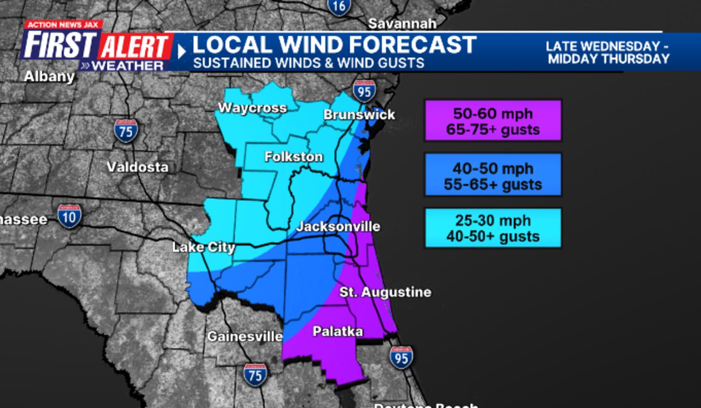
Local impacts from the storm are expected to arrive Wednesday afternoon and linger into Thursday. The storm’s large wind field will impact our entire area.
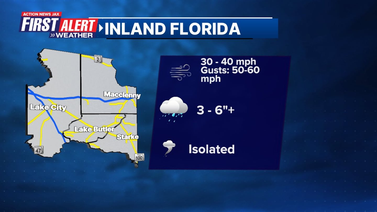
- Along the coast and the Interstate 95 corridor, winds are expected to be 50 to 60 mph with wind gusts of 65 to 75 mph.
- In Downtown Jacksonville, winds are expected to be 40 to 50 mph with wind gusts of 55 to 65 mph.
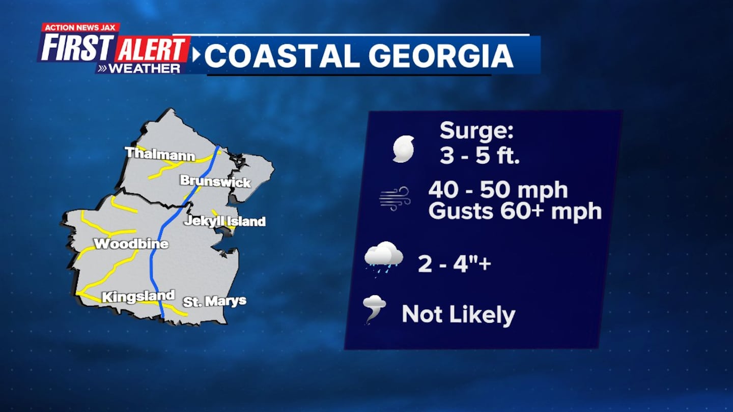
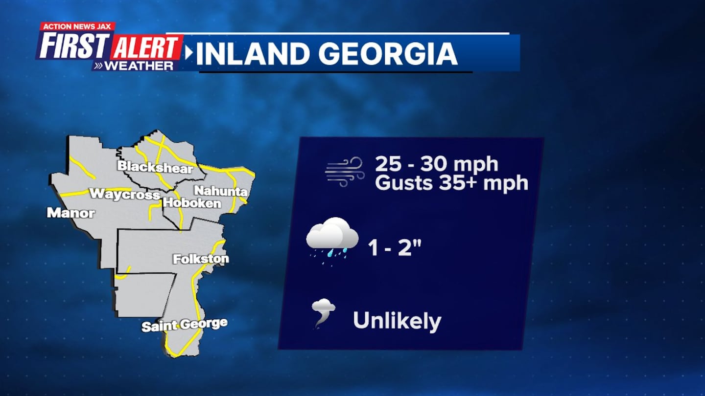
- Our northernmost counties in Southeast Georgia could experience wind speeds of 25 to 30 mph and wind gusts of 40 to 50 mph.
Here’s a link to more local impact details on Milton in "Talking the Tropics with Mike."
Read: Hurricane Milton: Closings, cancellations, and resources for Northeast Florida, Southeast Georgia
Read: Hurricane Milton: County-by-county list of school closures in Northeast Florida, Southeast Georgia
>>> STREAM ACTION NEWS JAX LIVE <<<
[DOWNLOAD: Free Action News Jax app for alerts as news breaks]
[SIGN UP: Action News Jax Daily Headlines Newsletter]
Click here to download the free Action News Jax news and weather apps, click here to download the Action News Jax Now app for your smart TV and click here to stream Action News Jax live.