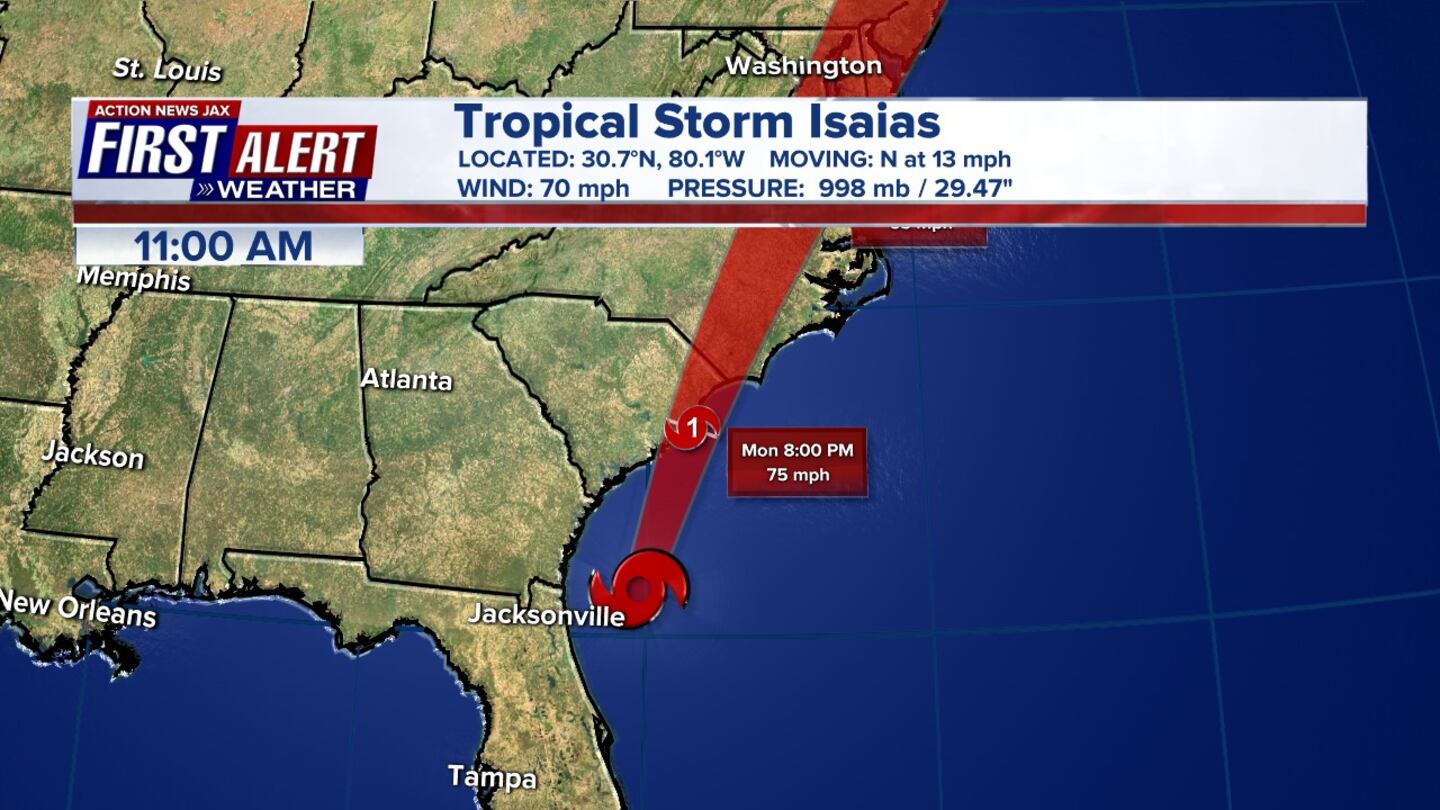
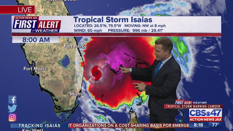
The First Alert Weather Team is tracking the storm known as Isaias. The storm upgraded to a Cat. 1 hurricane late Thursday night and downgraded to a tropical storm Saturday afternoon.
August 3:
11:36 p.m. Update: Hurricane Isaias made landfall in southern North Carolina around 11:10 PM near Ocean Isle Beach, with maximum sustained winds of 85 mph. A weather station at Oak Island, North Carolina, recently reported sustained winds of 76 mpm and a gust to 87 mph.
11 p.m. Update:
11pm #Isaias advisory Mon., 08/03 @wokvnews #FirstAlertWx pic.twitter.com/2p5vJvQ1og
— Mike Buresh (@MikeFirstAlert) August 4, 2020
8 p.m. Update:
8pm advisory update, Mon., 08/03 #Isaias becomes a hurricane again upon approach to the Carolina coast... moving N/NE @ 16 mph - landfall soon near Myrtle Beach @wokvnews #FirstAlertWx pic.twitter.com/FGtYbKgSg7
— Mike Buresh (@MikeFirstAlert) August 3, 2020
11 a.m. Update: All Tropical Storm Warnings over land are no longer in effect, according to the latest advisory for Isaias.
The storm is currently 90 miles east southeast of Brunswick and 80 miles northeast of Jacksonville Beach.
8 a.m. Update: Tropical Storm Isaias is moving faster north and still forecast to pass well offshore. According to the latest advisory, Isaias is still forecast to restrengthen and become a hurricane later today.
5 a.m. Update: Isaias is once again forecast to strengthen into a hurricane by early this afternoon well offshore from the Georgia coastline.
The storm is southeast of Jacksonville’s coastline. It will be east of Jacksonville Beach (by 90+ miles) by midday. The greatest impacts are along the immediate coastline.
Latest Track of Tropical Storm Isaias:
2:00 a.m. Update: Chief Meteorologist Mike Buresh says the storm still has a shot of becoming a hurricane over the next 12-18 hours. Right now there are 20-30 mph winds for much of the area with it blowing a little stronger at the beaches. There is an isolated threat of a tornado or waterspout.
August 2:
11 p.m. Update: The storm is moving a little more east
11PM advisory update #Isaias Sun., 08/02 - a little more east @wokvnews #FirstAlertWx pic.twitter.com/y3PxheJmAH
— Mike Buresh (@MikeFirstAlert) August 3, 2020
8 p.m. Update: Location is about 55 miles ESE of Cape Canaveral, about 385 miles south of Myrtle Beach, SC. Maximum sustained winds 70 mph. Severe weather watches now in effect for the Carolinas. A tropical storm warning is in effect from Sebastian Inlet, FL to Ocracoke Inlet, NC.
5 p.m. Update: Isaias strengthens slightly while moving NNW. The storm is currently offshore of the east-central coast of Florida. Hurricane watch and storm surge warnings issued for portions of the Carolinas.
2 p.m. Update: No changes other than moving 1 mph faster to the NNW. Still looking to be off our coast Monday AM-Monday PM as a tropical storm. Next update is at 5 p.m.
11 a.m. Update: Tropical Storm Isaias continues to bring heavy rain and strong winds over the Northwestern Bahamas.
The Storm Surge Watch for the Florida east coast has been discontinued. Tropical Storm Warnings are now canceled for Clay, Putnam, inland Duval, and inland St. Johns counties.
Tropical Storm Warnings remain in effect for all of our coastal neighborhoods in northeast Florida and southeast Georgia.
STORY: Duval County summer camps, athletic practices canceled ahead of Tropical Storm Isaias
central pressure of #Isaias down a bit in the 8pm NHC advisory Sun., 08/02... still with winds just below hurricane strength N & E of the center @wokvnews #FirstAlertWx pic.twitter.com/GZgJC9p4lH
— Mike Buresh (@MikeFirstAlert) August 2, 2020
8 a.m. Update: No major changes to Tropical Storm Isaias. Tropical storm conditions are close to the southeastern coast of Florida.
5 a.m. Update: The storm is now forecast to remain a tropical storm as it approaches Florida.
5 am advisory for Tropical Storm #Isaias. #FirstAlertWX pic.twitter.com/mAGpcZvRVi
— Garrett Bedenbaugh (@wxgarrett) August 2, 2020
2 a.m. Update: Isaias remains a tropical storm with wind speeds at 70 mph. The NHC said the storm is currently located about 90 miles southeast of West Palm Beach, Florida.
Here is the 2 am advisory for Tropical Storm #Isaias. #FirstAlertWX pic.twitter.com/tdbX09RvXD
— Garrett Bedenbaugh (@wxgarrett) August 2, 2020
August 1
11 p.m. Update:
No major update on the latest advisory. Isaias still a tropical storm currently in between the Bahamas and Southeast Florida.
11pm #Isaias advisory update Sat., 08/01 - Fl. coast "hugger" @wokvnews #FirstAlertWx pic.twitter.com/2htQh0AfcY
— Mike Buresh (@MikeFirstAlert) August 2, 2020
8 p.m. Update:
Chief Meteorologist Mike Buresh says the pressure of Tropical Storm Isaias lowers some, forward speed continues to slow. Isaias is expected to be near W. Palm Beach & Ft. Pierce midday Sunday and east of Jacksonville midday Monday.
8pm #Isaias advisory update - pressure lowers some... forward speed continues to slow.... expected to be near W. Palm Beach & Ft. Pierce midday Sunday & east of Jacksonville midday Mon. @wokvnews #FirstAlertWx pic.twitter.com/9oBFMnWARf
— Mike Buresh (@MikeFirstAlert) August 1, 2020
6 p.m. Update:
5 p.m. Update:
5pm advisory #Isaias Sat., 08/01 - weaker but potential to re-strengthen @wokvnews #FirstAlertWx pic.twitter.com/JQL5uTP6dz
— Mike Buresh (@MikeFirstAlert) August 1, 2020
- Chief Meteorologist Mike Buresh says, latest advisory shows Isaias has been downgraded to a tropical storm.
- Indications are that Isaias will now hold a steady-state or strengthen slightly into Saturday night while moving northwest, then more northward, but not before reaching - or hugging - the southeast coast of Florida late Saturday night into Sunday.
- The track looks to be anywhere from 40-70 miles east of NE FL and SE GA, with the closest approach late Sunday night into Monday morning.
- On this track, impacts locally - which do not appear severe for Northeast FL and Southeast GA.
2 p.m. Update:
#Isaias is quite literally seemingly falling apart after track over Andros Island... we'll see what the 5pm NHC advisory has in store, but it's looking like a potentially weaker tropical cyclone through at least Sun. night @wokvnews #FirstAlertWx pic.twitter.com/8yn2quEfn6
— Mike Buresh (@MikeFirstAlert) August 1, 2020
- Location is about 115 miles south of Freeport, Bahamas, 140 miles southeast of Fort Lauderdale
- Maximum sustained winds 75 mph
11 a.m. Update:
- A tropical storm watch has been issued from North of Ponte Vedra Beach to Altamaha Sound, Georgia.
- A tropical storm watch from the Volusia/Flagler County line from Ponte Vedra Beach has been changed to a tropical storm warning.
8 a.m. Update:
#firstalertwx #HurricaneIsaias hurricane struggling some while approaching Florida: https://t.co/J9yRWDMAED - "Talking the Tropics With Mike" @WOKVNews pic.twitter.com/gTJUyMXDee
— Mike Buresh (@MikeFirstAlert) August 1, 2020
- The hurricane warning for the central Bahamas has been discontinued
- A hurricane warning is in effect from Boca Raton to the Volusia/Flagler County line
- A hurricane watch is in effect from Hallandale Beach to the south of Boca Raton
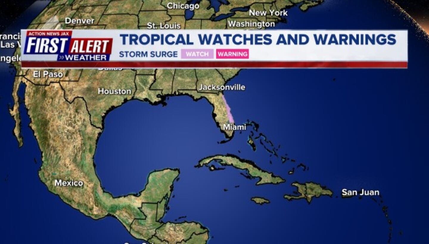
- A storm surge watch is in effect from Jupiter Inlet to Ponte Vedra Beach
- A tropical storm warning is in effect from north of Ocean Reef to the south of Boca Raton
- A tropical storm warning is in effect from the Volusia/Flagler County line to Ponte Vedra Beach
5 a.m. Update:
Meteorologist Alyssa Pejic says Isaias’s track has now shifted to the east roughly 30 miles. The intensity forecast still remains the same, but the storm’s forward motion is slowing down slightly. Tropical Storm Watches are in effect for the Flagler County line to Ponte Vedra Beach
July 31
11 p.m. Update:
Chief Meteorologist Mike Buresh says Isaias not seeing a whole lot of change and has moved slightly west, a little slower.
#firstalertwx 11pm #HurricaneIsaias advisory Fri., 07/31 - not a whole lot of change.... slightly west, a little slower @WOKVNews pic.twitter.com/tZzcBB81gr
— Mike Buresh (@MikeFirstAlert) August 1, 2020
8 p.m. Update:
Chief Meteorologist Mike Buresh says Isaias is getting a little stronger, but moving a little slower.
8pm #HurricaneIsaias Advisory update - a little stronger, moving a little slower @wokvnews #FirstAlertWx pic.twitter.com/nlvjsJH9zf
— Mike Buresh (@MikeFirstAlert) July 31, 2020
5 p.m. Update:
Chief Meteorologist Mike Buresh says there is a Tropical Storm Watch and Storm Surge Watch for St. Johns County, as well as a Hurricane Watch for Daytona to Sebastian Inlet, and a Hurricane Warning Sebastian Inlet to Miami-Dade.
#firstalertwx 5pm #hurricaneIsaias advisory Fri., 07/31 tropical storm & storm surge WATCH north to St. Johns Co... hurricane WARNING SE Fl. coast - landfall near W. Palm Beach about Sat. night... about 70 miles east of Jax Beach Sun. night @WOKVNews pic.twitter.com/JnBhNpF4Ar
— Mike Buresh (@MikeFirstAlert) July 31, 2020
Here is the 5 pm forecast track for Hurricane #Isaias. #FirstAlertWX @ActionNewsJax @WOKVNews pic.twitter.com/wR2nx9afzr
— Garrett Bedenbaugh (@wxgarrett) July 31, 2020
Noon Update:
“Due to extreme high tides and unpredictable ocean conditions caused by Hurricane Isaias, beach driving on all St. Johns County beaches will be restricted beginning at 5 p.m. on Saturday, August 1,” the St. Johns County Sheriff’s Office said.
Stay Informed: Download the FREE First Alert Weather app for severe weather updates straight to your phone
11 a.m. Update:
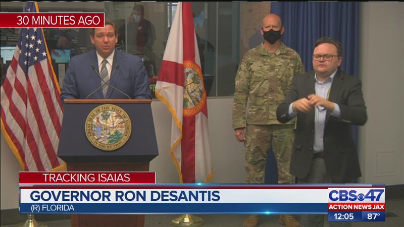
The forecast advisory shifts slightly west. In a news conference Friday morning, Gov. Ron DeSantis declared a state of emergency in all Florida coastal counties on the east coast.
Zoomed look at the "cone" for #Isaias. "Slightly" west. #FirstAlertWX @ActionNewsJax @WOKVNews pic.twitter.com/GzppebbSHb
— Garrett Bedenbaugh (@wxgarrett) July 31, 2020
LUNCH UPDATE | The latest track for hurricane #Isaias. See what has changed since the morning's update on CBS47 @actionnewsjax at Noon. #FLwx #FirstAlertWX pic.twitter.com/qzYfbtn3rD
— Garrett Bedenbaugh (@wxgarrett) July 31, 2020
Zoomed look at the "cone" for #Isaias. "Slightly" west. #FirstAlertWX @ActionNewsJax @WOKVNews pic.twitter.com/GzppebbSHb
— Garrett Bedenbaugh (@wxgarrett) July 31, 2020
8 a.m. Update:
Isaias remains a Category 1 hurricane. It has wind speeds of 80 mph. The strong winds and heavy rain are currently lashing the southeastern Bahamas and the Turks and Caicos Islands.
8 AM advisory is in for Hurricane #Isaias. #FirstAlertWX pic.twitter.com/sxRzAQLao6
— Garrett Bedenbaugh (@wxgarrett) July 31, 2020
#firstalertwx #HurricaneIsaias - "Talking the Tropics With Mike": https://t.co/IU8KkiMzXL - hurricane conditions for parts of the Bahamas through tonight... uncomfortably close to SE Fl. Saturday @WOKVNews pic.twitter.com/yVjwzrHnGt
— Mike Buresh (@MikeFirstAlert) July 31, 2020
5 a.m. Update:
The latest advisory is in for Hurricane Isaias. It’s now forecast to be a Cat. 2 hurricane as it crosses the central Bahamas.
5 AM advisory is in for Hurricane #Isaias.
— Garrett Bedenbaugh (@wxgarrett) July 31, 2020
Now forecast to be a Cat 2 hurricane as it cross the Central #Bahamas @ActionNewsJax @WOKVNews pic.twitter.com/BZ5COUcV5I
Great time to download the @ActionNewsJax #FirstAlertWX app as we approach the weekend. We can keep you updated on #Isaias with videos from us.https://t.co/ZDQFQdVHzv pic.twitter.com/gcHMXHuMMK
— Garrett Bedenbaugh (@wxgarrett) July 30, 2020
Cox Media Group

