JACKSONVILLE, Fla. — First Alert Neighborhood Weather Network. Scan below &/or click * here *:
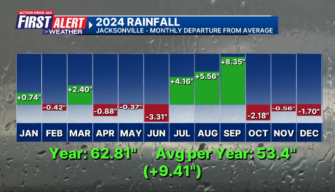
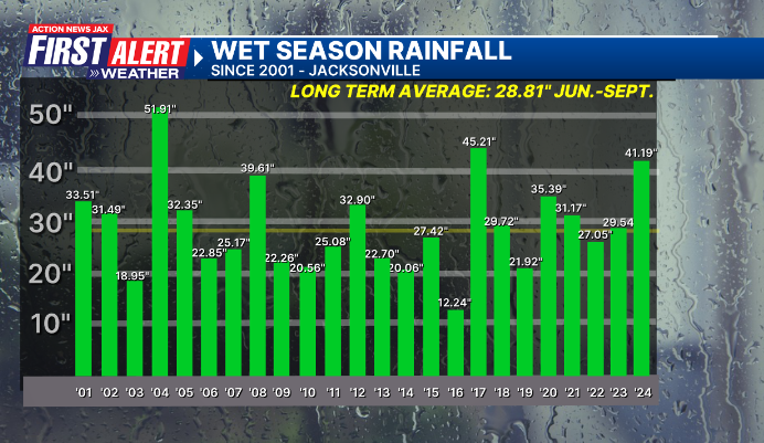
It’s been nothing short of a busy year of weather! In 2024, Jacksonville broke or tied 8 record highs, broke or tied 5 record high lows & every months was above avg. except for Feb. which was right at avg. While Jacksonville had the wettest July/August/September on record, there was a wide variation vs. normal from one month to the next in what ended up being the wettest year since 2017 nearly 9.5″ above avg. And the local area was impacted by Helene in September & Milton in October.
Local + a few national highlights from 2024 or I’m calling it - “If You Don’t Like the Weather, Just Wait a Minute”:
JANUARY - avg. temp. 54.8 degrees/+0.6 degrees.... rainfall: 4.02″/+0.74″
9th - EF-0 tornado in Bartram Park
27th - 84 degrees ties the record high for the date set in 1962.
FEBRUARY - avg. temp. 57.5 degrees/0.0 degrees... rainfall: 2.44″/-0.42″
2nd - a personal honor - I was named Federal Alliance for Safe Homes (FLASH) “Weather Person of the Year”. A big surprise & a heartfelt thank you to all that so faithfully voted :) - read my personal thoughts in the “Buresh Blog”.
3rd - Cedar pollen peaks (1477 cubic meters)
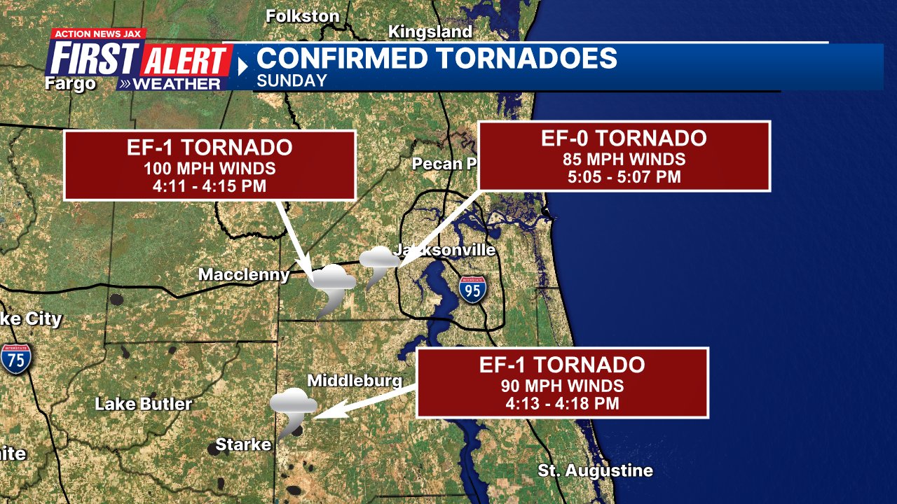
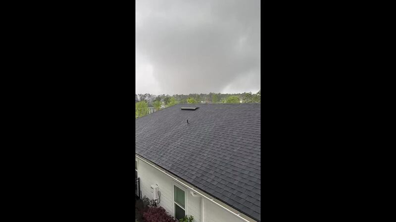
4th - EF-1 tornado in Clay Co. + EF-1 & F-0 tornadoes in SW Duval Co. Pics & video * here *.

6th - Pine pollen peaks (1004 cubic meters)
18th - Daytona 500 rained out & moved to the next day.
MARCH - avg. temp. 65.5 degrees/+3.1 degrees... rainfall: 5.69″/+2.40″
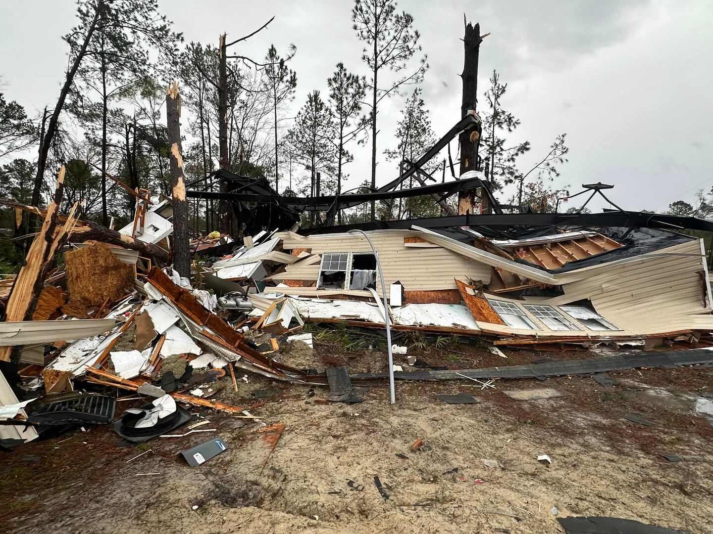
9th - EF-2 tornado near Nahunta, Ga.

12th - Peak oak pollen (8536 cubic meters)
APRIL - avg. temp. 68.7 degrees/+0.6 degrees... rainfall: 2.05″/-0.88″
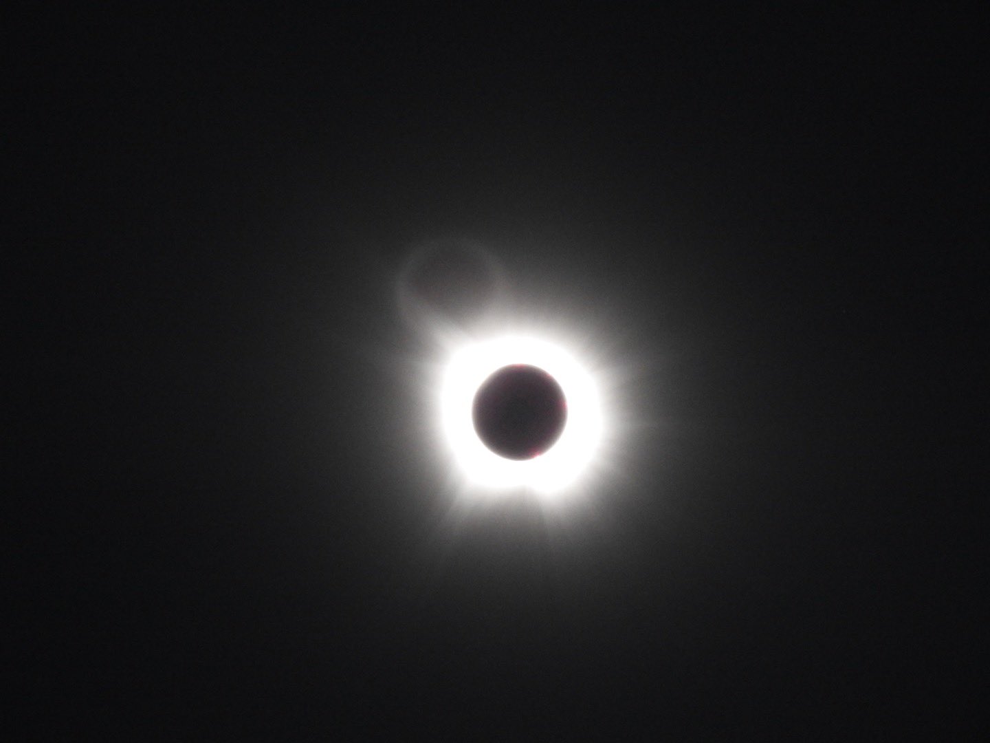
8th - partial solar eclipse over NE FL/SE Ga. including an Action News Jax watch party on the campus of UNF... I was lucky to view totality in North Texas! (my eclipse blog * here *)

From near Paris, Tx:
11th - EF-1 tornado in Trailmark subdivision (World Golf Village)
19th - first 90-degree day of the year, the average is May 5
MAY - avg. temp. 78.3 degrees/+3.4 degrees (6th warmest May on record)... rainfall 3.05″/-0.37″
9th - tie record high of 96 degrees (1962) ... 15th straight day with a tornado in the Lower 48
10th - severe wind gusts across NE Fl. of 50-70 mph... 2 EF-2 tornadoes in Tallahassee... Northern Lights visible over NE Fl. & SE Ga.
17th - Houston severe derecho kills 8
21st - EF-4 tornado hit Greenfield, Iowa killing 5
Isaac Polanski:
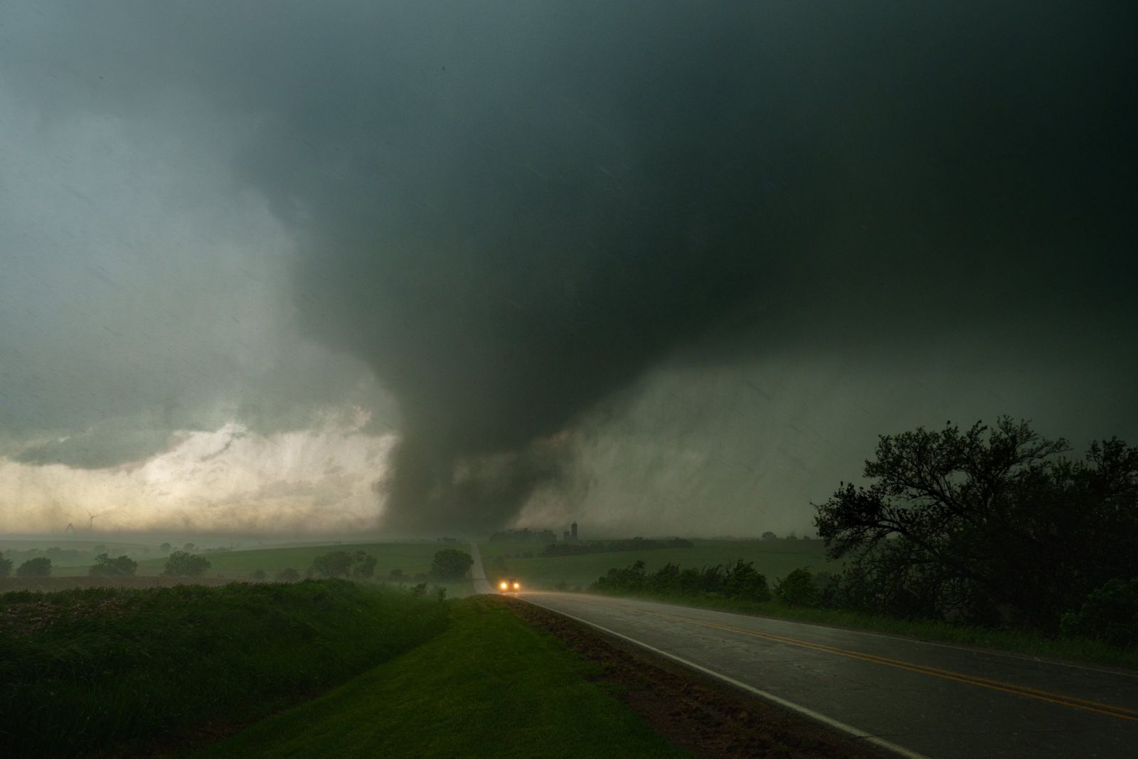
26th - third straight day of tornadoes from Texas to Kentucky killing 20+
JUNE - avg. temp. 82.6 degrees/+2.3 degrees... rainfall 4.29″/-3.31″
8th - tie the daily record high of 99 degrees set in 1993
19th - the first tropical storm of the Atlantic season forms over the Bay of Campeche (SW Gulf) & makes landfall the next day on the coast of Mexico
23rd - tie the daily record high of 100 degrees (2022)
24th - the “wet season” begins in Jacksonville
28th - EF-1 tornado along Beach Boulevard, Southside of Duval ... tropical depression #2 forms over the Central Atlantic & becomes tropical storm “Beryl”
29th - Beryl goes hurricane4 east of the Caribbean - earliest so far east
30th - Beryl becomes the earliest Cat. 4 on record over the Atlantic
JULY - avg. temp. 84.5 degree/+2.0 degrees... rainfall 10.93″/+4.16″ - 10th wettest July on record
1st - Cat. 4 Beryl landfall on the Central Lesser Antilles
3rd - Cat. 4 Beryl landfall on the far southwest coast of Jamaica
8th - Cat. 1 Beryl landfall on the Southeast Texas coast
AUGUST - avg. temp. 83.1 degrees/+1.0 degrees... rainfall 12.44″/+5.56″ - 6th wettest Aug. on record... June/July/Aug. - 2nd warmest in Jax since 1971
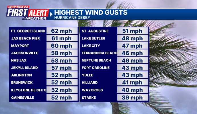
2nd - tropical depresson #4 forms over Cuba & becomes tropical storm “Debby” on the 3rd
4th - Debby goes hurricane over the Northeast Gulf of Mexico
5th - Cat. 1 Debby landfall on the Florida Big Bend near Steinhatchee - “Buresh Blog” for the Debby details.
17th - Cat. Ernesto Bermuda landfall
SEPTEMBER - avg. temp. 79.7 degrees/+0.9 degrees ... rainfall 13.53″/+5.97″ - 16th wettest Sept. on record... third straight month with 10″+ of rain - first occurrence of such since 1871... wettest July/August/Sept. - 36.90″/+15.69″
5th - 3-day rainfall over Central/South Duval of 6-12″
9th - E-Town, SE Duval rainfall 10.01″ ... tropical storm “Francine” forms over the W. Gulf becoming a hurricane the next day
11th - Cat. 2 Francine landfall on the southeast coast of Louisiana
12th - State of Emergency due to flooding in Fernandina Beach

15th - 13-day rainfall of 15-22″ from I-95 to the beaches
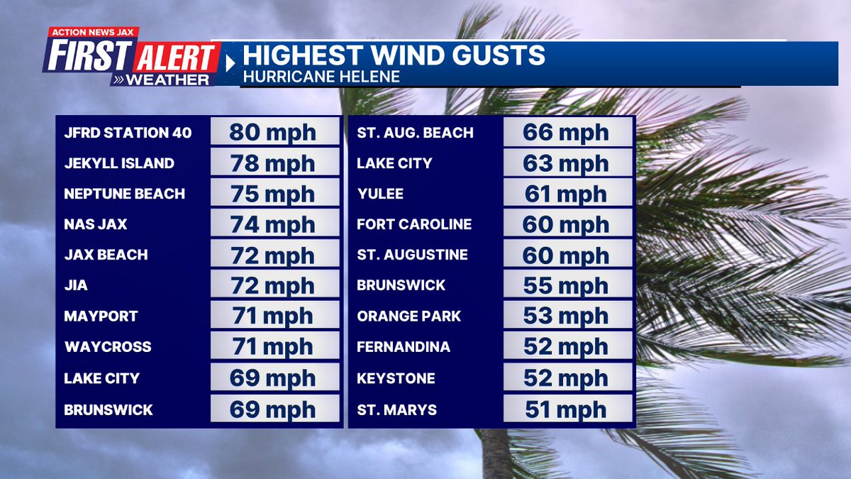
24th - tropical storm “Helene” forms over the Northwest Caribbean & becomes a hurricane the next day over the Southern Gulf of Mexico
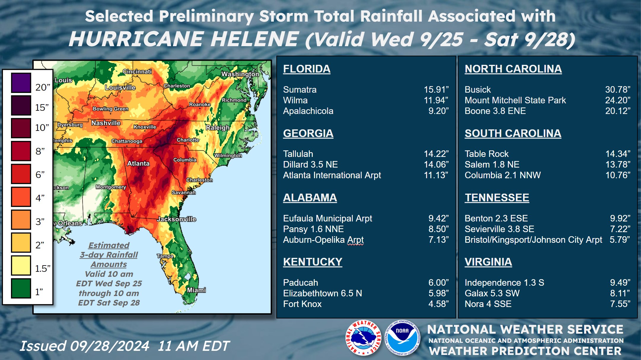
26th - Cat. 4 Helene landfall at 11:10pm EDT Big Bend of Fl. 10 miles southwest of Perry, Fl.... widespread power outages from Lake City through SE Ga... scattered power outages Duval Co. & areas near/north of I-10. “The Hell that was Helene” - Buresh Blog.
27th - Severe Helene flooding over portions of N. Carolina, Georgia & Tennessee.
OCTOBER - avg. temp. 72.2 degrees/+1.0 degrees... rainfall 1.85″/-2.18″
5th - tropical storm Milton forms over the Western Gulf of Mexico, becomes a hurricane on the 6th & a Cat. 5 on the 7th
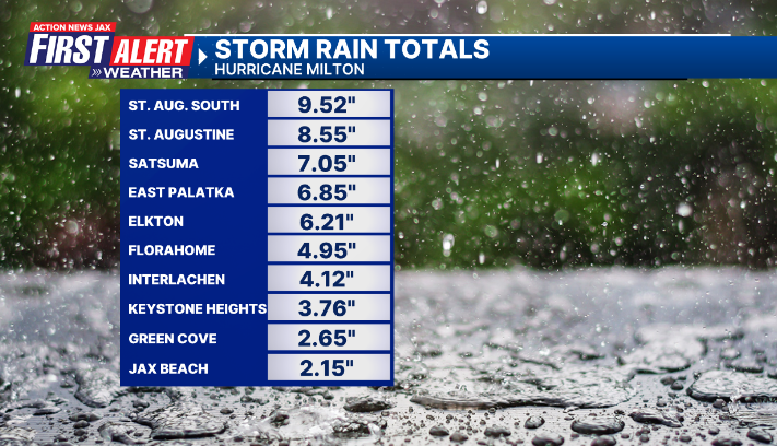
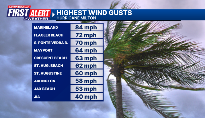
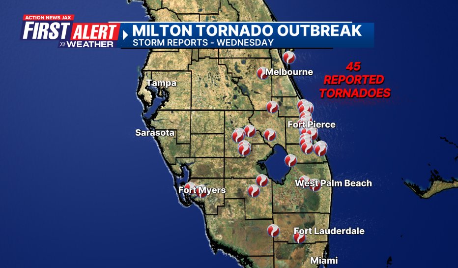
9th - Cat. Milton landfall on the west coast of Fl. near Siesta Key south of Tampa at 8:30pm EDT... heavy rain & gusty winds over NE Fl. into the 10th. A record-breaking tornado outbreak across South Florida. See the Buresh Blog for a summary on “Mighty Milton”.
10th - the Northern Lights again visible over Northeast Fl./Southeast Ga.
13th - Rip current death at Mickler’s Landing
24th - 87 degrees ties the record high for the date last set in 1927
NOVEMBER - avg. temp. 67.8 degree/+5.5 degrees... rainfall 1.44″/-0.56″
6th - record high low of 72 degrees (71/1961)
7th - record high low of 74 degrees (71/2019) ... tie the record high of 87 degrees (2003)
8th - tie record high low of 71 degrees (1946) ... tie the record high of 85 degrees (1892)
DECEMBER - avg. temp. 57.0 degrees/+0.3 degrees... rainfall 1.08″/-1.70″
1st - 4th - overnight lows at JIA at or below 32 degrees - first time since 1876 that the first 4 days of Dec. hit freezing.
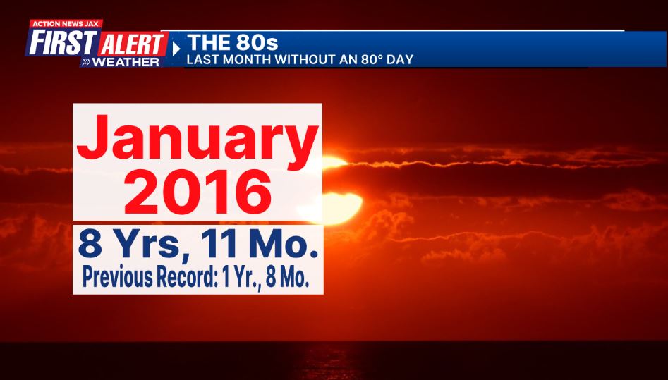
NO 80-degree day all month. Marks the first time since Jan., 2016 without at least one 80 degree within a single month. The 8 years, 11 months far exceeds the previous record of 1 year, 8 months (since 1871).


