JACKSONVILLE, Fla. — Become a part of the First Alert Neighborhood Weather Network. Scan below &/or click * here *:
Updated every day - “Talking the Tropics With Mike”. And the tropics are indeed off & running. Beryl took advantage of very warm ocean water + other nearly ideal conditions to become an unseasonably strong hurricane for so early in the season. Beryl was the farthest east over the Atlantic a hurricane has been recorded to form so early in the season... & is the 3rd earliest Atlantic major (Cat. 3+) hurricane on record, behind Alma (6/8/1966) and Audrey (6/27/1957). And once Beryl intensified into a Cat. 5 Monday night (July 1st), it was the earliest Cat. 5 in the Atlantic Basin ever beating the old record by nearly 3 weeks - “Emily” on July 17th during the infamous 2005 hurricane season.

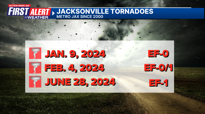
An EF-1 tornado touched down Fri., June 28th in Duval County along Beach & Southside Blvd. Born from a sea breeze generated thunderstorm, the tornado took advantage of a short period of localized decent wind shear (wind changing direction with height) to track nearly 1.5 miles with a width near 200 yards & winds up to 100 mph. The “poster child” for the tornado is the video below from DriveLineLLC showing a vehicle getting tossed by the *relatively* weak tornado - vehicles are one of the worst places to be during a tornado. Another vehicle approaching stopped just before running into the rolled vehicle.
#firstalertwx from DriveLineLLC - video of a tornado touching down on Beach Blvd. shortly after 2:30pm EDT Fri., 06/28. No injuries reported. @ActionNewsJax @WOKVNews @NWSJacksonville pic.twitter.com/U8WCByxn9D
— Mike Buresh (@MikeFirstAlert) June 28, 2024
This tornadic severe t’storm intensified very quickly. First Alert Doppler HD below at 2:15pm shows the storm with some lightning followed by the next radar image just 10 minutes later showing a dramatic increase in the storms over Arlington where 3.4″ of rain fell in little more than an hour. The tornado developed on the southwest flank of the storm to the west of the core & drifted west with the developing & strengthening storm.
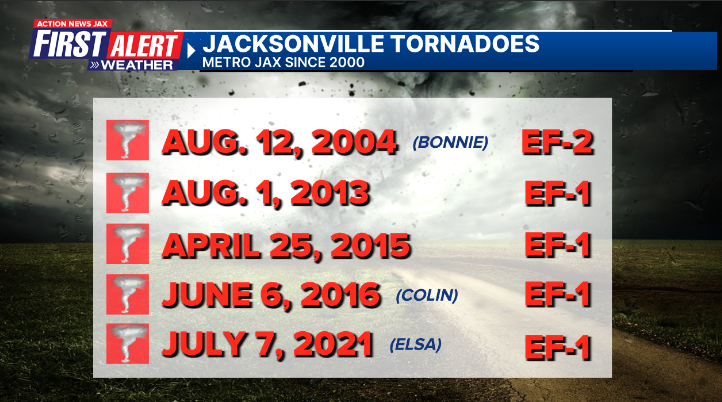
While not particularly common, tornadoes occasionally occur in Duval Co. including 4 twisters already this year.
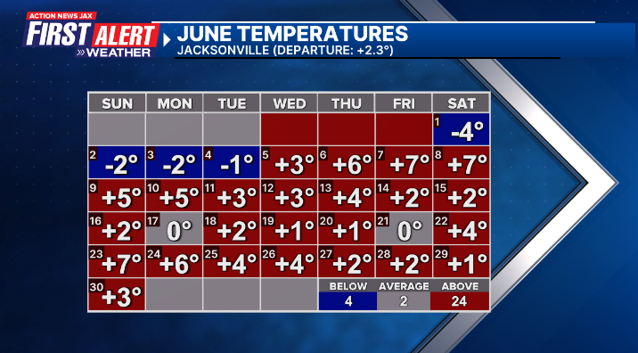
June is in the weather “books” & - for Jacksonville - was hotter than avg. & drier than avg. (official #’s at JIA):
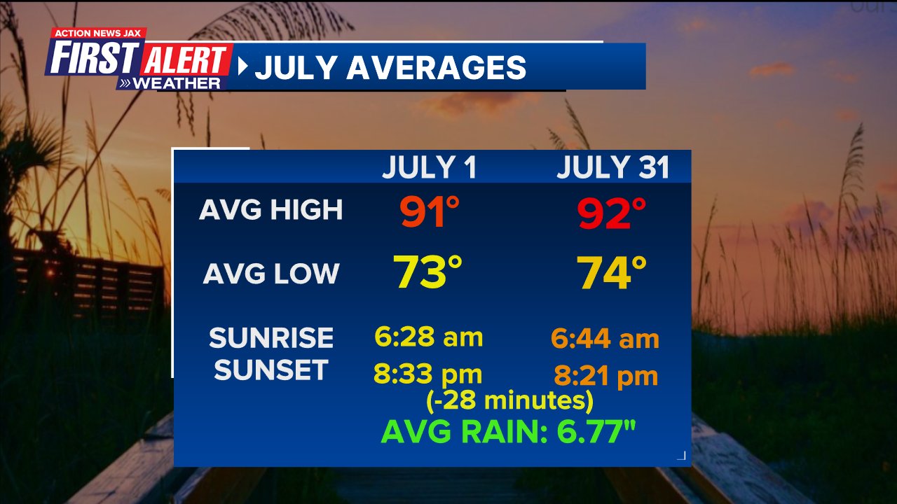
July averages (JIA):
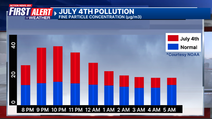
The 4th of July - Independence Day - means a lot of fireworks. And no surprise - NOAA research shows a spike in fine particulate (smoke) from 9-11pm during the evening of the 4th. Depending on weather conditions, the higher than avg. pollution can linger through early morning on the 5th before enough wind develops & the typical temp. inversion breaks allowing for the low level smoke to dissipate.


