JACKSONVILLE, Fla. — Action News Jax’s First Alert Weather Team is tracking a dry and warm day with a rip current risk at the beach.
First Alert Meteorologist Trevor Gibbs says temperatures on Saturday will rise from the 60s inland and 70s at the coast to the 80s in the afternoon. There will be plenty of sunshine and dry weather, which will lead to an elevated wildfire risk.
Sunday will be mostly dry, but an inland afternoon shower or storm is possible.
WATCH THE FORECAST | DOWNLOAD THE APPS
Onshore winds will keep a moderate to high risk of rip currents at area beaches this weekend.
There is no significant or widespread rain expected over the next week.
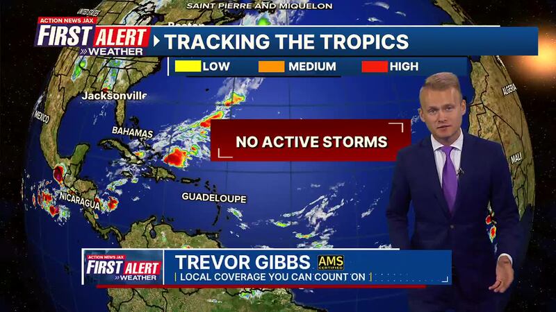
Gibbs also wants to remind everyone that hurricane season starts today, so the First Alert Weather Team’s eyes will be on the tropics these next few months.
Action News Jax’s First Alert Weather Team will continue to monitor the forecast and will bring you updates throughout the day.
Follow Action News Jax Meteorologists on Twitter for updates:
Mike Buresh | Garrett Bedenbaugh | Corey Simma | Trevor Gibbs
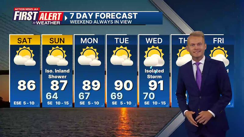
Here’s a look at your First Alert 7-Day Forecast:
TODAY: Partly cloudy. HIGH: 86
TONIGHT: Mostly clear and comfortable. LOW: 64
LISTEN: Mike Buresh ‘All the Weather, All the Time’ Podcast
SUNDAY: Partly sunny, isolated inland afternoon shower/storm. High 87/Low 64
MONDAY: Partly sunny and warmer. High 89/Low 67
TUESDAY: Partly sunny. High 90/Low 69
WEDNESDAY: Partly cloudy with an isolated afternoon storm. High 91/Low 70
THURSDAY: Partly sunny with a few afternoon storms. High 93/Low 70
FRIDAY: Partly sunny, an isolated afternoon storm. High 94/Low 70
INTERACTIVE RADAR: Keep track of the rain as it moves through your neighborhood
SHARE WITH US: Send us photos of the weather you’re seeing in your area