JACKSONVILLE, Fla. — Action News Jax’s First Alert Weather Team is tracking a hot and humid day ahead with a few afternoon showers.
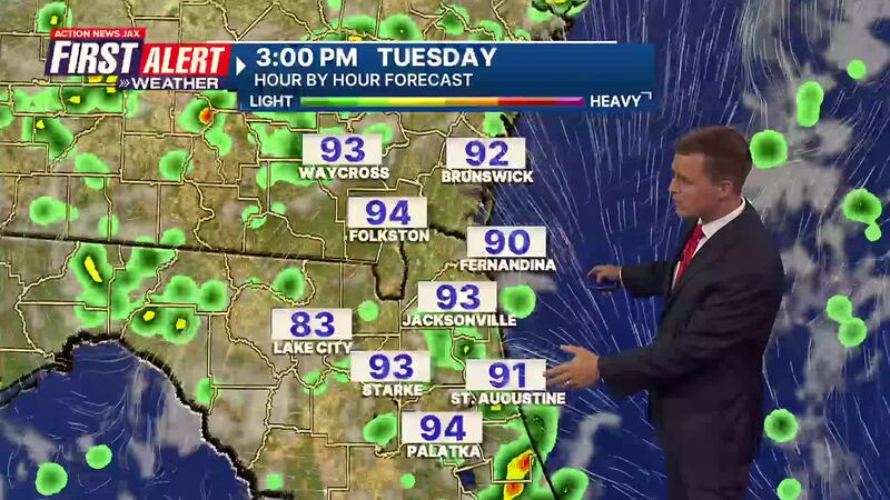
First Alert Meteorologist Garrett Bedenbaugh says this Tuesday morning will be dry and muggy with temperatures in the 70s. Highs will reach the mid-90s inland and the lower 90s along the coast later today. Feels-like temperatures will be 105+ before any rain or storms arrive.
A few showers and storms will begin developing before lunchtime west of Jacksonville and spread east through the afternoon. A few late-day showers and storms will continue near and after the early evening commute.
WATCH THE FORECAST | DOWNLOAD THE APPS
Heat and humidity will continue through the week with daily chances of rain and storms primarily in the afternoons.
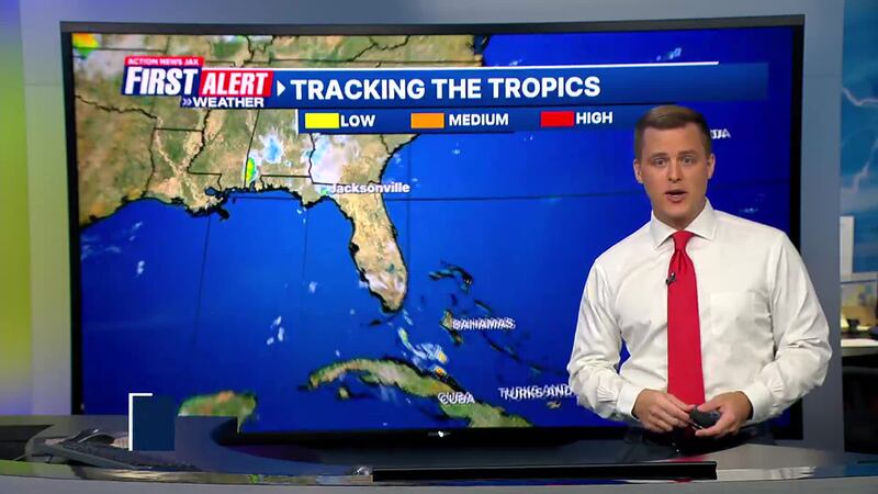
There are no areas of concern in the tropics.
Action News Jax’s First Alert Weather Team will continue to monitor the forecast and update you throughout the day.
Follow Action News Jax Meteorologists on Twitter for updates:
Mike Buresh | Garrett Bedenbaugh | Corey Simma | Trevor Gibbs
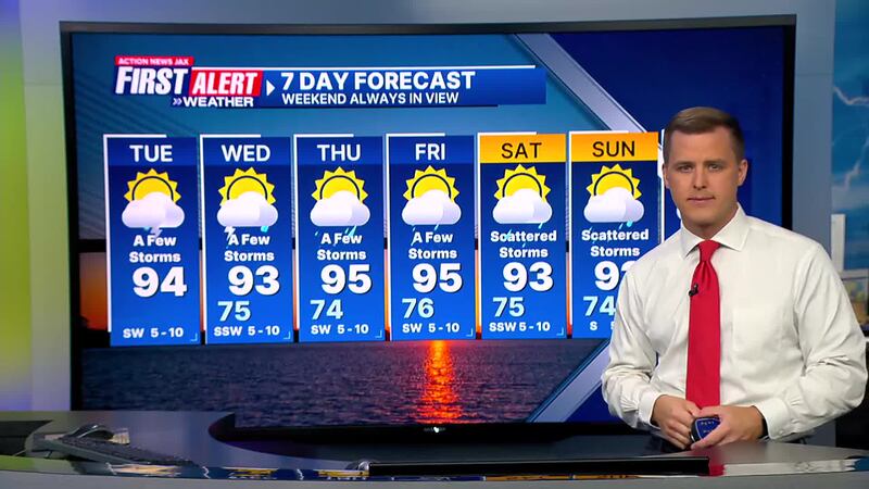
Here’s a look at your First Alert 7-Day Forecast:
TODAY: Partly cloudy, hot and humid with a few midday and afternoon storms. HIGH: 94 (Feels like: 105+)
TONIGHT: Rain ending, humid and becoming partly cloudy. LOW: 75
LISTEN: Mike Buresh ‘All the Weather, All the Time’ Podcast
WEDNESDAY: Partly cloudy with widely scattered storms. High 93/Low 75
THURSDAY: Partly sunny with a few storms. High 95/Low 74
FRIDAY: Partly sunny with a few storms. High 95/Low 76
SATURDAY: Partly sunny with scattered storms. High 93/Low 75
SUNDAY: Partly sunny with scattered storms. High 92/Low 74
MONDAY: Partly sunny with a few afternoon showers/storms. High 90/Low 75
INTERACTIVE RADAR: Keep track of the rain as it moves through your neighborhood
SHARE WITH US: Send us photos of the weather you’re seeing in your area