Jacksonville, Fl. — The “Buresh Bottom Line”: Always be prepared!.....First Alert Hurricane Survival Guide... City of Jacksonville Preparedness Guide... Georgia Hurricane Guide.
STAY INFORMED: Get the * FREE * First Alert Weather app
FREE NEWS UPDATES, ALERTS: Action News Jax app for Apple | For Android
WATCH “Talking & Tracking the Tropics: The Science Behind the Season”
WATCH “Preparing for the Storm”
READ the First Alert Hurricane Center “Survival Guide”
***** ALWAYS CHECK & RE-CHECK THE LATEST FORECAST & UPDATES! *****
The Caribbean & SW Atlantic will remain areas to keep an eye on for tropical development into November (climatologically favored too).
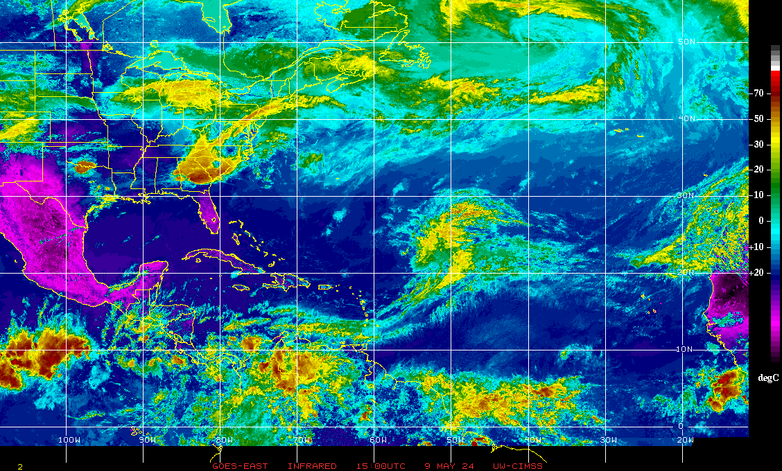
The next area of concern is already taking shape over the Central Caribbean in the form of a strong tropical wave. There’s a good chance this disturbance becomes the record-tying (for most storms in a single season) “Eta” over the weekend then moves into Nicaragua & Honduras as at least a tropical storm by Monday. On this track, there would be no impact to Jacksonville/NE Fl./SE Ga. or any of the U.S. (for a change!).
Yet another area to watch will be the Central &/or Eastern Caribbean in 10 days to 2 weeks. Forecast models seem to be struggling with “all the low pressure” at low latitudes including the tropics. So we’ll see a good deal of changes & fluctuating in the coming days with - at times - some fairly wild “end games” / solutions with where tropical systems might go & strong they might be. No need to panic & certainly no time to jump on individual model runs though I suspect we will see such on social media & within some media “circles”.
In any case... a second tropical system may evolve over the Central or Eastern Caribbean within the next week - 10 days. Interestingly... the GFS model take what should become Eta after moving near Central America northward toward Florida. The European takes Eta into Central America then develops a new & separate storm to the east. The UKMET is similar to the Euro.
A tropical system moving north out of the Caribbean becomes a very viable concern by next weekend as the upper level flow goes back to what we’ve seen most of the hurricane season. A trough over/near the Central U.S. with increased ridging near Fl. or perhaps a little to the east. How this all evolves will be critical in steering whatever tropical systems are lurking. Stay tuned!


More spaghetti:

The upper level ridge - at least for now & through the middle of the week - has shifted south which should steer initial disturbance ’96-L' westward - probably into Central America. However, the ridge will likely pop back north &/or northeast to some degree after this week which *could* open the door again for anything else that might develop over or near the Caribbean.
Atlantic Basin wave forecast for 24, 48 & 72 hours respectively:


The next area to watch for possible additional tropical development will again be the Caribbean through the first 10 days or so of Nov.


Saharan dust:

2020 names..... “Wilfred” was the last name on the Atlantic list (names are picked at random by the World Meteorological Organization... repeat every 6 years... historic storms are retired (Florence & Michael in ’18 & Dorian is certain to be retired from the ’19 list). Interesting side note: the last six of the names on the ’20 list had never been used. So it’s on to the Greek alphabet. "Eta” is next... the first time the Greek alphabet has been used since 2005 (total of 27 named storms using 6 Greek letter names in ’05)


East Atlantic:


Mid & upper level wind shear (enemy of tropical cyclones) analysis (CIMMS). The red lines indicate strong shear:
Water vapor imagery (dark blue indicates dry air):

Deep oceanic heat content is impressive across the SW Atlantic, Gulf of Mexico & especially the Caribbean:

Sea surface temp. anomalies:


SE U.S. surface map:

Surface analysis centered on the tropical Atlantic:

Surface analysis of the Gulf:

Caribbean:

Global tropical activity:
The West Pacific has heated up recently & is now home to super typhoon “Goni” which will hammer the Philippines then weaken & hit Vietnam - their 5th tropical cyclone within the last month.
Yet another storm is developing & is expected to strengthen into a typhoon - “Atsani”


Cox Media Group


